 |
 |  |  |
 |
|
Publications are given in reverse chronological order. Those marked with an asterisk (*) indicate principal publications, mostly on sites and monuments that have been introduced to the scholarly world for the first time.
ABBREVIATIONS:
BSOAS: Bulletin of the School of Oriental and African Studies, University of London (Cambridge University Press)
ISSN: 0041-977X EISSN: 1474-0699
Available by subscription from Cambridge Journals Online
EI3: Encyclopaedia of Islam, Third Edition (E. J. Brill, Leiden-Boston)
ISSN: 1873-9830
Available on the Encyclopaedia of Islam website, http://referenceworks.brillonline.com/browse/encyclopaedia-of-islam-3
 Architectural Diversity in South Asian Islam (Natalie H. Shokoohy), Chapter 8 Architectural Diversity in South Asian Islam (Natalie H. Shokoohy), Chapter 8
in South Asian Islam, A Spectrum of Integration and Indigenization, Nasr M. Arif
and Abbas Panakkal (eds), Routledge, Oxford – New York, 2024 pp. 187- 213 and
figs. 8.1-8.15,ISBN 978-1-032-45170-1 (Hardback), 978-1-032-57475-2 (Paperback)
978-1-003-43953-0 (e-Book)
Indo-Muslim architecture is striking for its combination of techniques and styles, stemming from the association
of the subcontinent with other lands through trade, invasion and settlement. The early maritime traders used
indigenous beam and bracket methods and a restrained local ornamentation, employing Jain and Hindu
craftsmen for their religious structures. The earliest surviving buildings of one of these trading communities are at Bhadreśvar, where an ancient Jain temple and centre of pilgrimage exists to this day. Bhadreśvar, on the coast of Kachchh (Kutch) in Gujarat, was once a magnificent ancient port. It was known to Ptolemy in the second century as Bardaxema and to al-Bīrūnī, writing in the eleventh century as Bhadra. The overseas traders dealt with the council of Jain merchants of the town, and a local Sanskrit chronicle mentions the Muslim community as “foreigners” of the Ismāʿīlī sect. The Jains gave the Muslims permission to build, and the most important Muslim building there is the shrine of Ibrāhīm, with its inscription of 554/1159-1160, the earliest date in situ on a monument in India. The environs of the shrine include two mosques: the Solahkhambī Masjid, and the Chhoṭī Masjid, all erected by local artisans.

The shrine consists of a square chamber with a corbelled dome, using the local technology, and on a plan which can be seen as a synthesis between Jain and Muslim architectural traditions. The miḥrāb, however, with its semi-circular plan and semi-circular arch, is in the style associated with Syria, Egypt and North Africa. A portico fronts the entrance featuring a flat ceiling decorated with a grid of squares with lotus patterns, which could be seen as a direct borrowing from temple architecture. The building, like all the Muslim buildings on the site, is constructed of large blocks of stone, a well-known method in India from ancient times, wiyh components including monolithic column shafts surmounted by brackets supporting lintels, roofed with flat slabs and corbelled domes.
Bhadreśvar, Kachh, Gujarat, above: Shrine of Ibrahim, the earliest standing Muslim building in
India. The concept of burial with a monument would have been unprecedented to the Jain host
community. Below: the Chhoṭī Masjid, a small mosque built by Muslim maritime traders with the
trabeate technology of a Jain or Hindu temple, but on a plan in accordance with the liturgical
requirements of a mosque. The porches in front of both buildings can be seen as a borrowing
from the concept of the maṇḍapa or open hall in front of a temple, and is a feature of the
mosques of Indian littoral

South India: shared technology of tiered wooden structures over stone walls. Left: the Mithqālpaḷḷi, a mosque built by merchants at Calicut.
Right: Bhagavati Temple at Cochin (Kochi). In spite of a superficial resemblance, the mosque’s planning makes it permeable and open from
the outside (the additions in the foreground are modern) while the temple interior is exclusive sacred space and out of sight.

Section of the west end of the Mithqālpaḷḷi showing its roof
structure with an example of its ancient antecedents, an
early fifth-century Buddhist wall painting from Cave 17 at
Ajanta depicting the roof space of a timber structure,
probably a monastery.
Travelling south, the architecture of the maritime traders in settlements all down the western and southern coasts of India again incorporates local building techniques and materials with the religious and social requirements of the traders. On the tropical coasts the traders would have found the main building material to be timber, and tiered structures the norm, from simple houses ‒ with the upper tiers providing airy lofts and at ground level patios protected from the sun and rain by deep overhanging eaves ‒ to elaborate multi-tiered temples.
The outer walls of the structures may be stone, but the joinery of the wooden superstructure employs pegs rather than nails and has ancient precedents and a wide geographic scope, being seen throughout South-East Asia and as far as China and Japan. The system used for laying beams and rafters is depicted in wall paintings in the Buddhist cave temples of Ajanta, and imitations of timberwork and joinery are also realised in the megalithic caves, although no actual timber structures of such an early period remain.
When it came to the conquerors of North India ‒ the Delhi Sultans ‒ the standing temples were objects of idolatry, but at the same time their stone elements were seen as instantly available building materials which could be taken down and reassembled into an approximation of the forms required. To demonstrate the establishment of the new power, the first act of dominance would be to demolish the towering temples, the symbol and centre of the old order, and build the place of worship for the new faith. A Muslim army’s key requirement was a place of prayer, and open areas known as namāzgāh, with a wall indicating the direction of Mecca would be set up ‒ large enough for the whole army ‒ some of which still survive. The sight of thousands of troops praying simultaneously would have been startling to the local population. The next move would be to build a mosque, as impressive, if not more so, than the standing temples. The components of these buildings ‒ built on the trabeate system based on beams resting on columns ‒ were held together not by mortar, but by the downward pressure of the weight of the stone components: all these could be used to build mosques, adopting the same system, but on a new plan. Careful reassembly on an entirely different layout resulted in decorative schemes that retained indigenous floral and geometric carved patterns, but human and divine images were defaced, or the stones turned back to front to use the plain surface, although carvings of animals were sometimes retained.

Ajmer, Rajasthan, Aṛha’i din kā Jhoṅpṛa, one of the first mosques built out
of the spoil of demolished temples by the Ghurids as a sign of conquest
in 588/1192‒3. Left: interior, three column shafts are superimposed to
create a huge lofty hall, with a roof of slabs resting on lintels combined
with reassembled corbelled domes, using the local building methods.
Right: the free-standing purpose-built screen wall added by Īltutmish
in c. 623/1225‒6 to give the mosque an outer appearance of the
vaulted ivāns of Iran, Afghanistan and Central Asia, the builders’
homelands
Numerous sultanate buildings have survived in Delhi and
in North India, providing a clear picture of architectural
developments of this era. The early sultans’ destruction
of temples as a religious duty and the reuse of spolia as
an act of symbolic appropriation is demonstrated in the
mosque of Quwwat al-Islām in Delhi, built in 588/1192‒3.
To the west, in Rajasthan, the mosque known as Aṛha’i din kā Jhoṅpṛa – meaning “the hut built in two and a half days” alluding to its speedy construction – was erected the same year. Like the Delhi mosque Aṛha’i din kā Jhoṅpṛa is laid on an Arab-type plan with a vast courtyard surrounded by colonnades. The appearance of such mosques, while striking, must, however, have seemed alien to the builders, and in both cases a freestanding screen wall was added as a compromise to provide some resemblance to the vaulted ivāns and arcades of the Ghurid homelands, but still using horizontal layers of corbelled stone, rather than employing true arches.
In a temple city spectacular processions would have been the norm. A Hindu city would have the palace and temple at its core with the arrangement of the dwellings of the various castes complying to sacred diagrams, according to the hierarchy, sometimes in rings of fortified walls, which may have appeared impressive, but would trap the inhabitants if surrounded by besiegers. In a Muslim city the arrangement is pragmatic and defensive. The palace complex is within the fort, which is set at one side of the walled town. The main mosque for the Friday prayers would be in the centre of the town, linked to the palace by a processional route. Graveyards – unknown in Indian culture, where the dead were not buried, but cremated – were sited outside the walled cities and villages. The extant monuments of these newly configured Muslim cities include not only mosques, tombs, and open prayer grounds known as ʿīdgāh (or namāzgāh of an army, also used for ʿĪd and other celebrations by the whole town), but other new forms of structure such Sufi khānaqāhs, minarets and madrasas (theological colleges). The conquerors encountered mighty Hindu fortifications as well as walled cities, and the local systems for water resources. These they adapted for their own use, but in their secular buildings such as fortifications, dams, stepwells, reservoirs and canals they displayed new and radically different approaches to dealing with their needs, employing a combination of new and indigenous techniques and materials.

Water distribution and infrastructure were crucial for survival and prosperity, and we see examples of the ancient type of open reservoir lined with stone ‒ with steps leading down to the water table ‒ either adopted or built, An example is the Jhalār Bāʾolī of Bayana, built by Malik Kāfūr Ṣulṭānī, the governor of Bayana under Mubārak Shāh Khaljī (reg. 716‒20/1316‒20), for the use of the public and perhaps partly to serve the needs of the Khaljī army in camp, but walled against the desert environment and embellished by a shady colonnade running all around the tank, with a roof terrace and four corner pavilions accessible by stairways, all of which would have provide a pleasant retreat in the cool of the mornings and evenings. Even now in its ruinous state it provides a micro-climate and haven for indigenous and migrating birds.
The Jhalār Bāʾolī of Bayana, Rajasthan, dated 717/1318‒19 and built
as a multi-functional retreat for the population. The water is accessible
via the steps even when the water table is low in Summer, as in the
photograph. The building was vandalised in the riots at the time of
the Partition of India in 1947

The tomb of Ghiyāth al-dīn Tughluq, Tughluqabad, Delhi. The tomb
reinterprets pizé in stone: to create a monumental effect the structure
is built with large blocks of red sandstone, with a string course and
niches of white and black stone inlay. The dome, clad with marble, has
a Muslim – Persian – profile, but is surmounted with an amalaka and
kalasha, borrowed from ancient Indian architecture, adorning the temple
śikharas and maṇḍapas as finials. The fine and well-proportioned design
of the tomb contrasts with the robust appearance of the enclosure and
the towering walls of the town and fort. The delicately fringed four-
centred arches add a sense of lightness to the otherwise massive walls.
When the conqueror’s rule became established, the influx of settlers from the cultural centres of Iran and Central Asia led to a consolidation of techniques and materials, combining trabeate and arcuate styles. Features such as the pizé walls of the homeland were reinterpreted as massive battered dressed stone walls, with contrasting stone inlay and fine calligraphy designed by Muslim master craftsmen. By the time of the Tughluqs (780‒817/1320‒1414), visual demonstrations of dominance were put aside in favour of practical measures for the consolidation of power and production of wealth. The sultans built not just monuments to demonstrate their authority, but, as their predecessors had also done, whole new cities on virgin ground, but grander, better designed and with a particular eye to the climate. Outside Delhi, Ghiyāth al-dīn Tughluq (reg. 720-25/1320‒25) built – in less than the five short years before his untimely death – a new capital for himself, Tughluqabad. The city, set by an artificial lake to provide a micro-climate, included the Sultan’s tomb. The substantial stone chamber is set in its own fortified enclosure reached by a causeway across the lake. The tomb employed battered walls, not for defence, but to add to the impact of the monument.
Architecture took an entirely different turn with the invasion of Bābur (reg. 932-7/1526-30) and the establishment of the Mughal empire. A new vocabulary developed, first seen in the Tomb of Humāyūn at Delhi, with its Persian-style domes, the burial place in a crypt, and the whole set in the centre of a Persian type of garden (chahār bāgh) divided by watercourses reflecting the tomb. This type of garden, built for pleasure, usually had the pavilion at the far end. In India, for the gardens around Mughal tombs, the tomb is at the centre, except notably in the Tāj Maḥal, where the tomb is at the far end, with a view to the river Jumna and a wide expanse of gardens on the opposite bank. The emperor Akbar was greatly interested in religious debate and the unification of religious ideologies. Jesuits were invited to his court to expound their views.
The emperor also attached importance to the Sufi Shaikh Salīm Chishtī. While a lavish dwelling would be inappropriate for a mystic teacher, the emperor was able to express his veneration by building an unparalleled mosque in the shaikh’s honour, in the new capital, Fathpur Sikri. The Mosque of Shaikh Salīm, built mainly of the finest red sandstone, exemplifies the empire’s and Akbar’s own cultural roots, the prayer hall being formed of three interconnected halls. The central one is in the Persian style, and has a triple arched opening, with a high transitional zone made of tall squinches with four-centred arched profiles supporting a Persian-style dome decorated with cartouches. The central hall opens on the north and south sides to smaller rectangular halls, constructed according to traditional Indian architecture with monolithic columns, beams and brackets supporting flat roofs, and which in turn connect with two halls, smaller than the central one, and alluding in style to Anatolian architecture: the transitional zone of the ribbed domes being supported on pendentives.
 The arcade surrounding the courtyard is once again in traditional Indian style, in the idiom of the early conquest mosques, though purpose built, with tall columns and brackets supporting the slabs of the flat ceiling, but with the façades being arched. In the central chamber, the miḥrāb, inlaid with stone decoration in restrained geometric patterns, unifies the whole composition. The arcade surrounding the courtyard is once again in traditional Indian style, in the idiom of the early conquest mosques, though purpose built, with tall columns and brackets supporting the slabs of the flat ceiling, but with the façades being arched. In the central chamber, the miḥrāb, inlaid with stone decoration in restrained geometric patterns, unifies the whole composition.
Fathpur Sikri, Uttar Pradesh. The interior of the mosque built by Akbar in honour of Shaikh Salim Chishti in c. 979/1571–72. An architectural statement of empire, the interconnected prayer halls exemplify the architectural traditions of Iran, Anatolia and India itself.
The synthesis of architectural traditions continued throughout the Mughal period, and elements were adopted in Rajput architecture. Later, at the time of the British, grand public buildings still drew from the traditions laid down in Mughal and Sultanate architecture giving Indian architecture its unmistakable appearance

Muslim Epigraphy and Ornamentation: its Diversity in South Asian Culture, (Mehrdad Shokoohy)
Chapter 9 in South Asian Islam, A Spectrum of Integration and Indigenization, Nasr M. Arif and
Abbas Panakkal (eds), Routledge, Oxford – New York, 2024 pp. 187- 213 and figs. 9.1-9.16,
ISBN 978-1-032-45170-1 (Hardback), 978-1-032-57475-2 (Paperback) 978-1-003-43953-0
(e-Book)
From the day Islam was introduced to India the Muslims brought with themselves the Word, in the form of the
verses of the Quran, the Traditions of the Prophet and historical narratives. Muslims did not first arrive in India
with the sword. They came as friendly merchants bringing gold in exchange for the wonders that India could
offer ‒ from pearls and jewels to silk and fine muslin along with spices and other rarities. Welcomed by their
Hindu and Jain hosts, by the nineth century the maritime traders had established settlements, recorded by the early Muslim geographers. Their twelfth century settlement in Bhadreśvar (Bhadreshwar) on the coast of Kutch, represents what the two cultures could offer each other. While the Muslims brought with themselves the concepts of egalitarianism in their places of worship – mosques and shrines – open to all, they also brought the art of presenting the word. The mid-twelfth Muslim remains at Bhadreśvar are set close to the main Jain temple, indicating a close relationship between the two communities, although they probably lived in separate quarters. In Bhadreśwar we see some of the earliest examples of the Kufic script in India, represented in a frieze in the Shrine of Ibrahim as well as on several tombstones of the same era.

Bhadreśvar on the Gulf of Kutch, Gujarat. Above: Shrine of Ibrāhīm,
dated end of Dhi’l ḥijja 554 (11 January 1160), stone panels of the
portico, carved in the form of a wooden coffered ceiling, with a frieze
at the top of the wall bearing Quran II, 255 in a fine interlaced Kufic
script. Below: a tombstone bearing in fine Kufic a Quranic text, and
recording the death one Sumra son of Farhā[d]? in Jumādā I, 573
(October–November 1177). Only a small portion of the epitaph is
seen in the picture.
 Such an integrated approach by the Muslim maritime traders was not restricted to a specific settlement but characteristic throughout the Indian littoral in subsequent periods. The merchant communities of South India incorporated Indian – religious Hindu – motifs freely in their early edifices, such as the fourteenth-century Mithqālpaḷḷi (rebuilt in 986–7/1578–9) in Calicut. An example is the vajramastaka, a common South Indian Hindu motif associated with protection from lightening, used on the eaves of the Greater Jāmiʿ mosque of Kayalpatnam (Jāmiʿ al-kabīr or Khuṭba Parriapaḷḷi), datable to 737/1336‒7, as well as on the Aḥmad Nainār Mosque, in the same town and dating from the same era, if not earlier. In this part of India the columns of the Muslim edifices adopt the elaborate details of Hindu decoration, apart from the representation of human figures. Such an integrated approach by the Muslim maritime traders was not restricted to a specific settlement but characteristic throughout the Indian littoral in subsequent periods. The merchant communities of South India incorporated Indian – religious Hindu – motifs freely in their early edifices, such as the fourteenth-century Mithqālpaḷḷi (rebuilt in 986–7/1578–9) in Calicut. An example is the vajramastaka, a common South Indian Hindu motif associated with protection from lightening, used on the eaves of the Greater Jāmiʿ mosque of Kayalpatnam (Jāmiʿ al-kabīr or Khuṭba Parriapaḷḷi), datable to 737/1336‒7, as well as on the Aḥmad Nainār Mosque, in the same town and dating from the same era, if not earlier. In this part of India the columns of the Muslim edifices adopt the elaborate details of Hindu decoration, apart from the representation of human figures.
Kayalpatnam, Tamil Nadu, Aḥmad Nainār mosque displaying the Hindu vajramastaka motif on the eaves.
To the right is a line drawing of the exterior projection of the miḥrāb, showing the same motif.
 Calicut provides a good example of this synthesis. The Muchchandipaḷḷi is one of the oldest mosques to have survived the onslaught of the Portuguese and the present building dates from the fifteenth century. The additional portico in front of the entrance features an elaborate coffered ceiling supported by highly decorated beams, all carrying Quranic inscriptions, except on one of the beams which bears a historical text recording the construction of the portico by one ʿAbd’ul-Qādir ibn Ibrāhīm in the late seventeenth centuty. The inscription is in relief and the calligraphy, while not of exceptional quality, is decorated with a band of intricate carved ornamentation, typically Hindu. In the context of cultural connections the motifs are of interest in that they comply harmoniously with Muslim decorative parameters. Calicut provides a good example of this synthesis. The Muchchandipaḷḷi is one of the oldest mosques to have survived the onslaught of the Portuguese and the present building dates from the fifteenth century. The additional portico in front of the entrance features an elaborate coffered ceiling supported by highly decorated beams, all carrying Quranic inscriptions, except on one of the beams which bears a historical text recording the construction of the portico by one ʿAbd’ul-Qādir ibn Ibrāhīm in the late seventeenth centuty. The inscription is in relief and the calligraphy, while not of exceptional quality, is decorated with a band of intricate carved ornamentation, typically Hindu. In the context of cultural connections the motifs are of interest in that they comply harmoniously with Muslim decorative parameters.
Calicut, the Muchchandipaḷḷi. Above: detail of the dated
inscription of the portico of the mosque. Below: the portico’s
coffered ceiling decorated with complex lotus flowers, and below
the inscriptions a register consisting of a series of vajramastaka
patterns intermitted with smaller vajramastakas flanked by lotus
leaves. Below this register is a highly floriated wavy patten,
common in Hindu ornament. The wood of the ceiling would
originally have been oiled, or stained with subtle colours. The
brightly coloured paint is modern.
The incorporation of Hindu, Jain and even Buddhist patterns is not confined to the edifices of the Muslim maritime settlers. This assimilation is evident from the very early period of the Muslim conquest of North India. In the twelfth century the political map of Iran and Central Asia was rapidly changing with the Turkish elements rising to power and eventually ending with the Mongol conquest a century later. Such changes led to the Ghurid conquest of Delhi at the end of the twelfth century, establishing Muslim power in North India, from the Punjab to Bengal.
 From the very early days the artisans were not inhibited about – or prejudiced From the very early days the artisans were not inhibited about – or prejudiced
against – learning, adopting and incorporating Hindu and Jain decorative elements
into their designs and combining them with their own. So, in the screen wall of the
Quwwat al Islām mosque in Delhi built in the late twelfth century and later extended
in the thirteenth century, in front of the prayer hall we see the combination of a well-
established traditional Muslim design with ancient Indian decorative motifs – Hindu
and Jain – not side by side, but amalgamated and well-integrated.
One would expect Muslim decorative and ornamental design to dominate, but the
Hindu traditional designs were so deeply rooted in the arts of North India that they
crept back into the architecture of Delhi. Taking the new gate built at the south of the
Quwwat al-Islām by ʿAlāʾ al-dīn Khaljī (reg. 695–715/1296–1316) we see that the
gate itself, in the form of a chamber, with three arches opening to the outside and
one leading to the courtyard of the mosque, follows traditional Muslim architectural
design of the Iranian world of the period, but executed in stone rather than brick.
However, on the face of an outer arch we see a curious pattern that may at first
seem like repetitions of a flower motif, common in Muslim designs, but when looked
at carefully manifests itself as a swastika, one of the holiest Hindu symbols, repeated
as a foliated pattern.
Delhi, Quwwat al-Islām mosque. ʿAlāʾ al dīn Khaljī’s
gate (dated 15 Shawwal 710/7 March 1311). Decorative
carvings on the pier of the arch, displaying a Hindu patten
of swastikas in the form of a field of repeating floral motifs.
The fourteenth century was a time for many innovations in North India, particularly under the patronage of Fīrūz Shāh Tughluq (reg. 752–90/1351–88), a learned man who designed buildings and cities. At this time a conscious synthesis of old Indian and Muslim art took place in architecture. A good example is the garden pavilion known as the Gūjarī Maḥal, apparently designed by Fīrūz Shāh to the north of the palace in the town of Hisar, also designed by the sultan and built under his personal supervision. While digging for the foundations of the palace some ancient Indian columns were uncovered, and Fīrūz Shāh made use of them in his royal mosque and in the garden pavilion, this time not as symbols of dominance, but simply for aesthetic reasons. On the interior of the Gūjarī Maḥal the pivotal elements are four ancient marble columns with fluted shafts, their elegant curved bases and capitals harmoniously supporting Islamic style arches and domes.
 Outside the territory of Delhi sultanate, the culture of Muslim Bengal was quite different. As the furthermost north-east region of the Subcontinent, Bengal had an older tradition of its own, related to the Muslim maritime trade with South-East Asia and China. As far as the language of the Muslim inscriptions is concerned, in South India – Kerala and Tamil Nadu – the inscriptions, both religious and historic, are in Arabic. On the other, hand in the north, including the regions of Delhi, Rajasthan, Gujarat, and as far south as the Deccan, as well as in Pakistan, the historic epigraphs are in Persian, while Arabic is reserved for quotations from the Quran and the Traditions of the Prophet (ḥadīth). In Bengal too the language of the ruling sultans was Persian, but many of their historic inscriptions are in Arabic. Persian became widespread only after the Mughals took over the region. The calligraphy of the Bengal sultanate is also different from that of the other regions, being mostly in the form of an interlaced thulth with elongated strokes for letters such as alif (a), lām (l) and kāf (k). Outside the territory of Delhi sultanate, the culture of Muslim Bengal was quite different. As the furthermost north-east region of the Subcontinent, Bengal had an older tradition of its own, related to the Muslim maritime trade with South-East Asia and China. As far as the language of the Muslim inscriptions is concerned, in South India – Kerala and Tamil Nadu – the inscriptions, both religious and historic, are in Arabic. On the other, hand in the north, including the regions of Delhi, Rajasthan, Gujarat, and as far south as the Deccan, as well as in Pakistan, the historic epigraphs are in Persian, while Arabic is reserved for quotations from the Quran and the Traditions of the Prophet (ḥadīth). In Bengal too the language of the ruling sultans was Persian, but many of their historic inscriptions are in Arabic. Persian became widespread only after the Mughals took over the region. The calligraphy of the Bengal sultanate is also different from that of the other regions, being mostly in the form of an interlaced thulth with elongated strokes for letters such as alif (a), lām (l) and kāf (k).
Gaur, the site of the old capital of Bengal. Above: inscription of
Shams al-dīn Yūsuf Shāh (reg. 879‒866/1474‒81) not in situ
but now fixed on the gate of the Qadam Rasūl mosque and
recording in Arabic the construction of a mosque in 885/1480‒1.
The only Persian word, pādshāh (king) is Arabized and the
Persian letter p is substituted with the letter b. The epigraph
is in thulth, with elongated letters interlaced with horizontal
strokes of the letter kāf, and large-sized letter nūn (n). The
style of the inscription is characteristic of most of the pre-Mughal
inscriptions of Bengal. Below: Tantīpara Mosque (c. 1480). The
decoration of the arch of the central entrance, formed with
moulded bricks decorated with interlacing vines with rosettes,
is perhaps an expression of the Hindu concept of the Tree of
Life, but represented almost like patterns.
The inscriptions of Bengal are not meant to be decorative, but simply informative. Nevertheless, ornamental features can be seen in many of the edifices in the form of glazed tiles and moulded brick. Bengal, formed by the estuary of the Ganges, is rich in clay and the tradition of brick construction goes back to the Buddhist era. Decorative tilework in Bengal is not sophisticated, as in the fourteenth to fifteenth century Deccan or in Multan, but can be found in many buildings of Gaur. However, ornamental moulded bricks are widespread and can be seen on the exterior of the buildings for the corner towers and on the spandrels of arches as well as on the interior mainly on the miḥrābs and other niches. A good example is in the Tantipara Mosque depicting vine decoration and rosettes, but alluding to the Hindu concept of the Tree of Life.
 The assimilation of all aspects of the Indo-Muslim visual arts with older The assimilation of all aspects of the Indo-Muslim visual arts with older
indigenous traditions is perhaps best seen in Gujarat. The Gujarat architects,
artisans and stone carvers incorporated the Jain and Hindu repertoire fully
into their designs. The amalgamation of the Muslim and Indian traditions
continued in the region unabated even after its conquest of the region at the
end of the thirteenth century by the sultanate of Delhi and later under the
independent Sultanate of Gujarat. Building out of temple spoil – exercised
formerly in North India as a sign of dominance – in Gujarat gave way to
constructing buildings in the same manner, but purposely designed,
employing traditional Indian motifs: the patterns of diamonds, lotus and
lotus leaves, serpentine scrolling patterns, miniature bas-reliefs of temples
and numerous other configurations. A good example is the depiction of the
design of the Tree of Life. We have noted an allusion to it in the arts of other
regions, particularly Bengal, but in Gujarat it appears first in the traditional
Indian form in the early mosques of the Sultanate of Gujarat, in the Grand
Jāmiʿ of Ahmadabad built in 826/1423.
Hindu motifs embellish all sultanate buildings of Gujarat, including the
sophisticated reservoirs such as Adalaj Wāv, a structure built in VE 1558/
1502 AD under the patronage of Sultan Maḥmūd Baigara (reg. 863‒917/
1458–1511) for the use of his Hindu subjects. In this reservoir we see not
only diamond patterns, hanging drops and rows of downward turned semi-
circular lotus patterns with a border of pearls, common in almost all
temples; above them are representations of a row of miniaturised North
Indian temple towers (śikhara). The Adalaj Wāv is not the only structure
built under the Muslim sultans for the majority population. The sultans
allowed their courtiers to patronise the construction of temples, reservoirs
and other Hindu or Jain edifices.
Ahmadabad. Above: Sīdī Saʿīd or Sīdī Sayyid’s Mosque, pierced stone window depicting the Tree of
Life in a design with pure Muslim antecedents that might be found as a pattern for a textile or
carpet. The carving is exquisite and the dark silhouette of the pierced stonework of the window
creates a fascinating play of light and shade in the interior of the mosque. Below: Adalaj Wāv, a
reservoir built by the permission of Sultan Maḥmūd Baigara for the use of his Hindu subjects and
adorned with Hindu ornamentation. Details of the balustrade of the underground platform.
In the late fifteenth and sixteenth century, the Muslim concepts of ornamentation gained strength gradually and familiar Muslim floral patterns began to appear in the carved decoration. From the early days of the Gujarat sultanate Muslim-style foliation can be found in the tombs of the wives of Aḥmad Shāh (reg. 813‒46/1410‒42), but later, foliation and floral motifs as well as Islamic geometric patterns appeared on many buildings. Most intriguing is the development of the representation of the Tree of Life. It began to lose the rigidity of the Hindu standard pattern, and became more realistic and foliated in design, as appears in many mosques and shrines. The tree eventually appears in its pure Islamic form on the pierced stone screens of the mosque of Sīdī Saʿīd (or Sīdī Sayyid). This mosque built in 978/1570‒1 is one of the latest edifices of the Sultanate period before the Mughal takeover of Gujarat.

Muslim art took a new turn in the sixteenth century when the Mughals invaded, creating a vast empire in North India, also wielding nominal power over the sultanates of the Deccan. Much has been written about Mughal art and their architectural heritage attracts visitors from all over the world. The Mughal inscriptions take many forms; apart from carving in relief they also created a large number of inscriptions in the form of inlay, often with coloured stone set in marble. This type of inscription was almost as long-lasting as those carved in relief, but created a smooth surface on the walls. They went even further, and, on the interiors, created inscriptions painted on the walls, often in gold, set within highly ornamented cartouches and other decoration. Their wall painting and inlay work merges together creating exquisite results. While the Persian influence was developing strong roots in the inscriptions and ornamentation of Mughal architecture, the technology of carving and inlay, particularly in marble, was Indian, even if not of ancient or Hindu origin. The best manifestation of it appears in the tomb of Iʿtimād al-daula, the Persian father-in-law of the Emperor Jahāngīr (reg. 1014–37/1605–27). As long as Iʿtimād al-daula was alive he virtually ran the Empire and when he died, his daughter, Nūr Jahān, the beloved wife of the Emperor, built a mausoleum for her father which is enriched on the exterior with marble inlay decorated entirely with Persian patterns similar to those which appear in Iranian wall paintings.
Mughal inscriptions and ornamentation at their zenith, during the reign of Shāh Jahān. Left: the lower shaft of a marble column and its base in the audience hall of the Emperor’s palace in the fort of Agra. The inlay is coloured stone as well as precious and semi-precious stones, creating a subtle, colourful and harmonious design. The small red stones are garnets and the light blue stone on the top of the centre of the base is turquoise. Other gemstones are also employed, including lapis lazuli. Right: view of one of the public rooms of Shāh Jahān’s palace in the Red Fort at Delhi. The flowing arabesque designs are similar to those seen in Agra, and derive from Persian ornamentation, but the lobed arches are characteristic of later Mughal architecture. In a cartouche above the arch is the first stanza of a Persian verse, with the other over the next arch not in the photograph, declaring: “If paradise could be on earth, it is this, it is this, it is this”. The inscription and many others of the period are in fine nastaʿlīq.
 Agra, the Taj Mahal, the mausoleum built by Shāh Jahān for his beloved queen and himself. Two panels Agra, the Taj Mahal, the mausoleum built by Shāh Jahān for his beloved queen and himself. Two panels
decorated with flowering shrubs are apparently taken from similar European patterns, but executed in
different materials. Above: detail from the mausoleum itself, with the plants carved in fine low relief in marble.
Below: a similar design rendered in red sandstone for the mosque of the complex. The deep shade of the
courser material contrasts with that of the tomb to set it to advantage. The panel from the mausoleum is
bordered by an interlaced floral pattern inlaid in the same manner as those seen in the palaces of Shah Jahān
while that of the mosque has a simple geometric zigzag border, as found in many earlier monuments.
A generation later, at the time of the Emperor Shāh Jahān (reg. 1038–68/1628–57) a
more subtle style of decoration developed which although it still had references to
Iran, was entirely Indian. Inlaid marble continued to be favoured, often incorporating
precious and semi-precious stones. The appearance was richer and grander than
anything seen before, but simpler in general design. At the same time, in the palaces
of Shāh Jahān, wall-painting and even painting of the ceilings became more elaborate,
often incorporating gilding. From the early days of the Mughals the Portuguese had
opened trade routes to India, South-East Asia and China, establishing small enclaves
as their territories all along the Indian Ocean coasts. The Portuguese found friendly
relations with the Mughal court expedient, and accepted, at least nominally, Mughal
dominance. This relationship resulted in a flood of European artifacts, engravings,
prints and drawings finding their way to the Mughal court and into the hands of the nobility. The effect of all this new material on Mughal art was great, and is seen particularly in later Mughal miniatures. Stone carvers and artisans were also influenced by the European images, for example in the depiction of flowering shrubs, which up to then had only been rendered in the Persian style. Delicately executed examples appear in the Taj Mahal, in the mausoleum itself as well as its associated structures.
India, throughout its history, has offered much to world culture, but has also been, and is still is, a melting pot of cultures. It has absorbed elements from civilizations beyond its boundaries – Arab, Persian and European – and integrated them into its own identity. To illustrate this, one should perhaps glance at the many details in the designs by Lutyens and Baker for the Secretariat at New Delhi, proudly displaying European, Hindu and Muslim elements – complete with Persian inscriptions – not side by side or in parallel, but in an amalgamation denoting the unification of diverse cultures.
Nagaur, Muslim history and art and architecture, EI3, Part 3, 2022, pp. 114-123, illustration 1-5

Nagaur, the Buland Darwāza of the Khānaqāh al-Tārikīn (733/1332-3),
view of the gateway from the south-west, outside the enclosure. The
simple tomb of Shaykh Ḥamīd al-dīn Chishtī is within the enclosure.
Nagaur in the desert terrain of Central Rajasthan is associated with its celebrated townsman, Abū’l-Faḍl b. Mubārak, the author of the Āʾīn-i Akbarī and the Akbar-nāma, and also for its Sufi shaykhs of the Chishtī, Qādirī and Suhrawardī sects. Nagaur itself was one of the oldest Muslim strongholds in India, and its district included a number of historic towns such as Didwana, Khatu, Ladnun and Naraina, all preserving numerous sultanate monuments from the thirteenth century to the time of the establishment of the Mughal empire in the sixteenth century and displaying a distinctive local architectural style. Nagaur fort also retains later palaces of the Rajput period embellished with wall-paintings.
The foundation of Nagaur goes back to the Ghaznavids, its fort being built by Muḥammad Bāhalīm (or Bahlīm), Multan’s Governor under Bahrām Shāh (1117-57). With the fall of the Ghaznavids Nagaur fell into the hands of the local Rajputs, but the Ghurid Muḥammad b. Sām (r. 1173-1206) took over the region in 588/1192-3, and his control was consolidated in 592/1195-6 by his commander (later Sultan) Quṭb al-dīn Aibak.
.

Nagaur, The early fifteenth century Shams Khān Masjid,
eastern façade of the prayer hall. Below: plan.
After Tīmūr’s sack of Delhi in 801/1398-9 the sultanate of North India disintegrated and in Nagaur an independent dynasty was established which was related by blood to the sultans of Gujarat. The founder of the independent state was Shams Khān whose dynasty lasted for over 120 years. The khans minted coins without acknowledging Delhi, although their coins have not been uncovered. Their independence is also confirmed by their inscriptions which do not acknowledge any sovereign sultan. During their reign in addition to the Sufi schools, a community of learned Jains flourished in Nagaur, leaving many manuscripts acknowledging the khans as sovereigns.

Tīn Darwāza of Nagaur, southern façade from the
middle of the central square (Ghandi Chowk). Below, plan.
An outstanding monument, and a landmark of Nagaur town, is the Buland Darwāza, the gate to the Khānaqāh al-Tarikīn, constructed during the reign of Muḥammad b. Tughluq in 733/1333; an arched portal of red sandstone,12 m. high, and flanked by two three-tiered square pavilions (chatrīs) each topped with a hemispherical dome. Two more pavilions are set on either side of the roof. Behind the portal, three chambers were added later, probably by the efforts of Makhdūm Ḥusain Chishtī (d. 901/1495-6) who took on the mantle of the khānaqāh in 859/1454-5.
The other landmark is the Shams Khān Masjid, the old Jāmiʿ of Nagaur, and a paradigm of the architecture of the independent khans. The style is an amalgam of Delhi and Gujarat. Built on the bank of a substantial reservoir, also known to be the work of Shams Khān, the prayer hall is massively built with five arches opening to large interconnected domed units. The central dome is raised over squat columns in the Gujarat style, but all domes are true domes as opposed to the corbelled domes of Gujarat.
In competition with their cousins, the Sultans of Gujarat, the khans remodelled Nagaur to resemble the Gujarat capital Ahmadabad (founded in 813/1410-11), complete with a royal square in front of the entrance of the fort with their own version of Ahmadabad’s ceremonial gate: the Tīn Darwāza. Nagaur, lacking the resources of Gujarat, made the khan’s attempts a pale imitation of the grand Gujarati architecture, but are perhaps best represented in Nagaur’s Tīn Darwāza. It consists of three archways, built with dressed sandstone with similar façades on both sides, but plastered over later. Each pier is decorated with a small arched balcony, making four on each façade, roofed with a domed profile similar to the form of a Hindu śikhāra. Above the central arch at the roof level on each side were stone balconies which are now lost. In spite of the general resemblance of the Tīn Darwāzas of the two towns, they differ in plan and in the treatment of the elevations. Apart from plainer façades at Nagaur a distinct difference is its Delhi-style four-cantered arches as opposed to almost two-centred arches at Ahmadabad.

Nagaur Fort, wall paintings in the Rajput palace, depicting carefree courtly recreations.
The combined North Indian and Gujarati style of architecture continued up to the mid-sixteenth century, but in time many of the distinctive Gujarati features, such as the imposts of domes being raised above the level of the roof, gave way to more traditional North Indian forms, and in particular the flat roofed colonnade.
During the Mughal period, Nagaur and its region fell in the hands of the Jhodpur rajas who accepted the soverign of the Mughal emperor and in the fort of Nagaur built palaces in the Mughal style, which have survived and been restored in recent years. The fort and its palaces are still the property of the Raja of Jhodpur.
South Asia, Chapter 5.2 in The Oxford Handbook of Islamic Archaeology, Bethany J. Walker, Timothy Insoll and Corisande Fenwick (eds), Oxford University Press, Oxford, 2020, pp. 543–573, figs 5.2.1–5.2.8
ISBN 978-0-199-98787-0 (hardback) ISBN 978-0-197-50787-2 (epub)

From the early days of European encounters with Indian culture, merchants, travelers and officials arriving in
India were astounded at the quantity of ancient remains, dominated by Hindu and Buddhist monuments, in every
state of repair: from richly endowed temples to picturesque ruins swallowed by jungle and enigmatic mounds
hinting at past civilizations. The Muslim presence in India goes back the first century of the Hijra, but their
monuments, as with those of the host communities, would be cared for mainly because of their religious rather
than their historic significance.
Formal archaeological studies in South Asia may be taken to have started in 1870 when the Archaeological
Survey of India (ASI) was established with Alexander Cunningham (1814–93) appointed as Director, but interest
in archaeology goes back much earlier. The value of the historic monuments and vast ruins was understood and
early in the nineteenth century two legislations – the Bengal Regulation of 1810 (Regulation 19:1-3) and the
Madras Regulation of 1817 (Regulation 7) – were designed to prevent vandalism, but with little effect as the East
India Company had only nominal authority over the Subcontinent.
Although at the beginning a scholarly approach to archaeology was lacking, what attracted enlightened officials of the East India Company was the Buddhist and Hindu monuments, ancient inscriptions and numismatics. They presented papers to the Asiatic Society of Bengal, published in its Journal. Islamic sites and monuments attracted less attention as they were ubiqitous and “too recent”. We come across papers regarding Muslim materials very occasionally, such as one on eight early Muslim silver coins published in 1851, two of which date from AH 121/738-9 and 162/778-9. Although at the time the archaeology of Sind and Multan was unknown, these two early Caliphate coins pointed to an Arab presence in Sind, and over a century later explorations of the historic Arab settlements enhanced our understanding of early Muslim architecture and urban form in South Asia. Delhi was, of course, the centre of Muslim power and its antiquities were described first in 1846, not in English, but in Urdu by Sayyid Ahmad Khan (1817-98).
However, the quality and characteristics of Indo-Muslim edifices were considered before this by James Fergusson (1808-1886), a Scottish architect who plied the subcontinent between 1834 and 1845 making measured drawings of the buildings. In 1876 he eventually published his History of Indian and Eastern Architecture which, while mainly concerned with Hindu and Buddhist antiquities, included survey plans of the then unexcavated Quwwat al-Islām mosque and the tomb attributed to Īltutmish in Delhi, Shīr Shāh’s tomb at Sasaram, the Ādīna Mosque at Pandua, the Jāmiʽs of Jaunpur and Ahmadabad and the mosque called Aṛha’i din kā Jhoṅpṛa in Ajmer. He also produced a sketch of the eleventh-century minaret at Ghazna, the upper tier of which has since fallen, making his sketch our only record of its design.
In 1870 the Indian Central Government established the Archaeological Survey of India (ASI), with the fifty-seven year old General Cunningham as Director. He and his few assistants explored the antiquities of various regions, publishing their reports in 23 annual volumes, each supported by sketches, measured drawings and renderings of inscriptions. The quality of the reports varies greatly. Those of Cunningham himself, while not entirely free of error, are more reliable but those of his assistants are often unprofessional, inadequate, inaccurate, and full of statements and anecdotes gathered from local pundits, presented as historical fact. An example is the report by Archibald C. L. Carlleyle (1831-97) on the town and fort of Bayana. The town was established by the Muslims in the first decade after the Ghurid conquest, yet Carlleyle devotes most of his report to the pre-Islamic fictional history, inventing a name for the town: “Bāṅāsur” and another for the fort: “Santipūr”. He ignored many of the Muslim remains, designated the Jāmiʽ mosque of the fort as a “temple converted to mosque” and described one of the most significant early conquest mosques as a temple. He gave an inaccurate sketch of the minaret of Dāwūd Khān in the fort. The shortcomings of this report were to the extent that Cunningham had to revisit the site and provide a fresh report correcting many of Carlleyle’s slips. With all their shortcomings, however, Cunningham and his assistants did set up the basis of systematic archaeological exploration, with a fair proportion devoted to the Muslim period. Nevertheless, their reports were regarded as unscientific and were criticised harshly at the time. In 1887 Sir F. S. Growse, the founder of the Mathura archaeological museum, publicly commented “The unrevised lucubrations of General Cunningham’s assistants are a tissue of trivial narrative and the crudest theories”, and the Quarterly Review of July 1889 noted "We trust that all future Reports issued by the Archaeological Department of the Government of India will be free from the defects which mar the usefulness and impair the authority of Sir Alexander Cunningham's Series”. For all that, Cunningham’s publications brought the extent and importance of Indian antiquities to the attention of the authorities.
The subsequent history of the ASI was not without ups and downs, but survived the test of time. The quality of its publications improved, reaching a zenith when the Viceroy, Lord Curzon (1859-1925), reformed the ASI, appointing a young archaeologist, John Marshal (1876-1958). Under his directorship the work of the ASI reached a highly profesional level and numerous volumes of exploration and excavation reports were produced. The inscriptions, in Sanskrit, as well as Arabic and Persian were also studied systematically. The ASI continues its work, its many directors of different calliber being appointed directly by the Central Government. The ASI is also responsible for the preservation, maintenance and repeair of sites and monuments. After Partition in 1947, while the ASI remained in charge of archaeology in India, in Pakistan and subsequently Bangladesh similar offices were established with their own archaeological departments.
Major Sites and Edifices
Eighth to early twelfth century
The Arab appearance on the coasts of India goes back to pre-Islamic times and large numbers of Roman, Byzantine and early Muslim gold coins found in India were brought via the Red Sea by the maritime traders from Syria, Iraq and elsewhere. Histories tell us that at the time of the Caliph Al-Walīd, when the Muslim ships were attacked by Indian pirates, in retaliation Muḥammad b. Qāsim took an army to Sind and first took over Daibul in 93/711-12 and within a year annexed Sind to the Caliphate. Excavations at the site of the port of Daibul at Banbhore have uncovered the perimeter of the walled town, small parts of the palace area and foundations of the main mosque with its inscription dated 109 /727-8), which makes the building one of the earliest known mosques in the world. The foundations reveal that the mosque had an Arab type plan with the usual colonnade around a central courtyard, but little survives to reveal the features of the superstructure. Further north, the village of Brahmanābād is the site of al-Manṣūra, the Arab capital of Sind, once a sizable city which is still left practically unexcavated, except the foundations of a large mosque (described by some as the Jāmiʽ) and a smaller one, both built of brick, the main building material in Sind and Multan. The excavated mosque seems to have been a walled prayer hall with a single entrance to a courtyard in the eastern side. Again, the superstructure is lost, but inside the prayer hall are the foundations of massive piers that may have supported an arcaded roof, or as some traces suggest, over each of these large piers two wooden columns probably supported a light roof.
Early in the eleventh century Multan and Swāt, to its north-east, were annexed to the Ghaznavid territory and excavations at Swāt have revealed a sizable Ghaznavid mosque, several times renovated, with stone walls and traces of wooden columns. The entire mosque was roofed and it seems that it did not have a courtyard – at least in its final form. Multan and the nearby town of Ucch retain other remains, almost all constructed of brick and many displaying glazed tilework, a reflection of the region’s association with Greater Khurāsān rather than South Asia. The oldest, the tomb of Shāh Yūsuf Gardizī (1152), has an unusual layout and structure for the region: oblong in plan and not domed. Other tombs, such as the tombs of Shāh Bahā’ al-Ḥaqq (d. 1262), Shams al-dīn Tabrīzī (d. 1276), Shādnā Shahīd (d. 1270) and Rukn-i ‘Ālam, are all built with battered walls reflecting the traditional mud-brick and pisé structures of Afghanistan.
Early Muslim geographers record many ports on the coasts of Gujarat with Muslim settlements, dating from the ninth and tenth centuries, including Khambāya (Cambay), Asāwul, Ṣaimūr, Sindān, and Sūbāra. Cambay remained a prominent port throughout history. Asāwul was later incorporated with the fifteenth century Ahmadabad and the site of Ṣaimūr has not yet been identified. Sindān, may be the same as a remote village of the same name on the coast of the Gulf of Kutch (Kachh), but the site has not yet been explored. Subāra on the other hand is likely to be the same as Bhadreśvar, also recorded as Bhīswāra, a port raided by Maḥmūd of Ghazna on his return from Somnath. Bhadreśvar retains the oldest dated Muslim monuments in India. The main mosque is a colonnaded structure with a small central courtyard and a large colonnaded portico in front of the entrance to the courtyard, a feature not seen in Banbhore and Brahmanābād. The dated structure, however, is the Shrine of Ibrāhīm, locally attributed to one Laʽl Shahbāz, bearing a Kufic inscription of 554/1160.
Numerous sites of Muslim maritime merchants are to be found in South India, in places such as Calicut, Cranganur and Cochin on the coasts of Malabar (present Kerala) and at the site of the historic Muslim port of Qā’il now called Kayalpatnam (the city of Kayal) in Tamil Nadu (still a Muslim town). The historic buildings of Malabar, dating from the fifteenth to eighteenth century, have stone walls with wooden columns and wooden tiered roofs. They do not have an enclosed courtyard and their porch usually opens to an ante-chamber leading to the prayer hall, an innovation from the planning principles seen in the earlier maritime edifices. The surviving edifices in Tamil Nadu (the historic Maʽbar of the Muslim records) are on the other hand built entirely of stone, and in their planning, with a portico opening to the prayer hall or shrine are closer in concept to the earlier maritime traditions seen in Gujarat. Numerous tombs and gravestones, from 806/1404 to recent eras include genealogies of Middle Eastern settlers. The Muslim archaeology of South India is still relatively untouched, leaving many sites throughout Tamil Nadu and Kerala to be explored and provide a better understanding of the history and cultural traditions of the maritime settlers in India and beyond.
Delhi: Muslim dominance, 1191 to mid-fourteenth century
North India was taken in 1191 by the Ghurids of Khurāsān, who, within two years established a powerful sultanate with Delhi as their capital. Their armies penetrated as far as Bengal, but the sultanate of Bengal generally remained aloof from Delhi. The Hindu Delhi was transformed to a Muslim city and in the next 150 years several other cities were built in its neighbourhood: first Kīlūgharī, founded in 685-8/1286-9; then Sīrī 698/1298-9; Tughluqābād 720/1320-21; Jahānpanāh c. 726/1326 and Fīrūzābad c. 760/1358-9. Early in the twentieth century, when New Delhi was built south of Shāhjahānābād (Old Delhi), traces of all the earlier cities were gradually buried under the new capital, except the more distant Tughluqābād, although it too is now being submerged under modern development. No systematic excavations were carried out in any of these towns and their historic urban fabric has been lost.
The architecture of the first few decades of the conquest could be crystallised into a few words: the Architecture of Dominance. It differs entirely from the architecture of the conquerors’ homelands, where arcuate engineering, with arches and domes was already in an advanced stage. The early Delhi sultans chose instead to build their mosques and tombs with temple spoil. Later with the Mongol invasion of Iran and Central Asia in 1221 causing a flood of architects, craftsmen and artisans to India, the traditions of Middle Eastern architecture, as seen in the tomb of sultan Balban and buildings of ʽAlā al-dīn Khaljī, replaced trabeate structural methods. By the fourteenth century, however, the Muslim and old Indian techniques coalesced creating a distinctive Indian architectural style, first appearing in early Tughluq buildings and reaching its maturity at the time of Fīrūz Shāh Tughluq. Yet the “Architecture of Dominance” did not die out and right up to the end of the fourteenth century was implemented in new regions conquered by the Delhi sultanate. Examples are the Jāmiʽ of Daulatabad in the Deccan, the mosques in Dhār, the early capital of Mālwa, and numerous mosques in Gujarat’s Saurashtra peninsular, mostly dating from the time of Fīrūz Shah Tughluq. This type of architecture is also seen in Jaunpur, the seat of the fifteenth-century independent Sharqī sultanate. Jaunpur was, however, devastated by the Delhi sultan Sikandar Lodī (1489-1517) sparing only a few mosques; the modern town now covers the ruins of the old.
Bengal (West Bengal, India and Bangladesh)
Muslim remains in Bengal demonstrate a marked difference from those of the rest of South Asia. Bengal, with its tropical climate and its isolation from Western India, had a substantial Buddhist culture with an ancient red-brick building tradition. Later Hindu temples were built of brick faced with blocks of stone. The Muslims inherited these traditions, rare elsewhere. The British ASI’s interest was mainly concentrated on excavation of Buddhist and Hindu sites, now mostly in Bangladesh. The ASI contribution to Muslim sites was, as usual, to clear the sites and reveal standing monuments, restoring some and preserving the ruins of selected others, but much remains to be investigated. The oldest Muslim remains, are in Tribeni (or Tribani), and are partly in ruins, but have stone walls and piers surmounted by brick arches and domes, characteristic of many later edifices. The Muslim capital, however, was Lakhnautī, the site of which is now divided between Bangladesh and India, covering a vast area of Gaur and Ḥaḍrat Pandua. The earlier buildings such as the Ādīna Masjid 776/1374 and Chota Sona mosque 899-925/1493-1519 have again stone or stone-faced walls supporting brick arches and domes, but the Buddhist influence in the former is demonstrated in the three-lobed arch of the miḥrāb, where in Buddhist iconography the arch frames the head and shoulders of the Buddha.
In later brick buildings liturgical requirements are observed, but often expressed idiosyncratically, both in planning and structural form. Many consist of a fairly small prayer hall often covered with a single dome, with a corridor in front or running around three sides of the hall. There are corner columns with the roof curved down towards the columns on all faces, imitating traditional domestic bamboo dwellings, as can still be seen in the peasant huts of remote villages. In about the fifteenth century glazed tiles were introduced in Bengal, displayed in many buildings. Most of the other sites are scattered in Bangladesh: in Bagerhat, Goardi, Mugapara, Sherpur and Sonargaon. Bagerhat and its nearby site Sherpur in particular preserve a large number of Sultanate monuments, Sherpur being rich in unreported ruins still awaiting exploration, excavation and restoration. Bengal was annexed to the Mughal Empire in 983/1575-6 by Akbar; the region has numerous sixteenth and seventeenth-century remains, including in the Bangladesh capital, Dhaka, principally a Mughal town, where the ruins of the Mughal fort and palaces attract visitors.
Mid-fourteenth to late seventeenth century: Central and South India
The brutality and mismanagement of the Delhi sultan Muḥammad b. Tughluq (1325-51) ended with the fragmentation of the Delhi Empire. Facing rebellions, the sultan himself had to remove his capital for a short time to Daulatabad in the Deccan. Well before Muḥammad’s death, independent sultanates were springing up in Maʽbar (Tamil Nadu) and the Deccan. The capital of the sultanate of Maʽbar was Madura and opposite the Hindu town is the enclosure containing the tombs of the two sultans – ʽAlā al-dīn Udaujī and Shams al-dīn ʽĀdil Shāh – housed in a domed chamber, surrounded by a colonnade, as well as a mosque and a few other tombs. In Tiruparangundram, where, in a battle with the Vijayanagar forces the last Maʽbar sultan, Sikandar Shāh, fell, a mosque has been built next to his tomb under an exposed rock.
The Deccan was at first divided into two kingdoms: the Bahmanī sultanate in the north, and in the south the Hindu Kingdom of Vijayanagar, which employed Muslims in its army and traded with the coastal Muslim communities, who sold them, among other things, numerous horses. Some of their edifices incorporate Muslim features, such as vaults and domes. The Bahmanīs, on the other hand, were devout Muslims, their founder ʽAlā al-dīn Bahman Shāh claimed Sasanian origin and the arches of their early buildings in their capital Gulbarga are crowned with a Sasanian style motif. Their structures, however, follow the North Indian style. Later, in 1429, the capital was taken to the newly-built Bidar, where the town still retains its original street layout and many monuments. In Bidar Fort the palaces employed wood extensively, but little survives, as when Bidar was falling to the Mughals the buildings were set on fire intentionally to prevent the enemy using them. Nevertheless, the prevalent high quality of the tile-work in the palaces and elsewhere indicates high levels of Deccani artistic achievement.
The Deccan, heavily influenced by Iranian culture, gradually became disposed to Sufi doctrines and by the late fifteenth century the Bahmanī realm eventually disintegrated into several smaller kingdoms: the Quṭb Shāhīs in Golkonda, where the fort and a number of edifices have survived, but are not fully investigated; the Barīd Shāhīs of Bidar who replaced the Bahmanīs and have left the ruins of some palaces in the fort and numerous tombs and shrines; the ʽĀdil Shāhīs of Bijapur and a number of smaller sultanates of short duration. The most significant archaeological remains are those of the ʽĀdil Shāhīs who built Bijapur as their new capital. Unlike other Muslim cities Bijapur has a roughly circular plan, approximating Hind urban planning, but Bijapur’s architecture is markedly original, developed from that of the Bahmanīs. The ʽĀdil-Shāhī territory went as far west as Goa which was taken by the Portuguese in 1510, but in the nearby town of Ponda stands the Ṣafā Masjid, a curious hybrid of ʽĀdil Shāhī architectural traditions and those of the maritime settlers.
Fifteenth to mid-sixteenth century: West India
The small and short-lived sultanate of Mālwa (1392-1531), set between Gujarat and the Deccan, has left many fine edifices, both in its first capital, Dhār and the second, Mandu. The major historical remains in Dhār are the mosque of Sultan Dilāwar Khān 808/1405-6; the fifteenth-century Kamāl Maulā mosque and tomb; and the Lāt ki Masjid, named after a pre-Islamic iron pillar originally re-erected in front of it; the broken pieces being preserved on the site. Mandu was built over a natural flat summit of a hill, and in its fort many palaces, ornamental reservoirs, and other historic edifices are preserved, some in fairly good condition. Marble, sometimes inlaid with other stones was favoured, and the seventeenth-century marble architecture of Shāh Jahān is indebted to Mandu, as it was his headquarters as a prince.
One of the archaeologically richest and also best-studied areas of West India is Gujarat, with numerous Islamic sites from both the pre- and post-conquest period. There is a legend in the Muslim world, unfounded but current at least since from the early eleventh century, that in the very early days of Islam the pagans of Mecca smuggled the idol Manāt – whose worship was forbidden in the Qur’an (LIII, 19-25), together with the worship of Lāt and ‘Uzzā – via the maritime route to Somnath, providing an excuse for Maḥmūd of Ghazna to sack the holy temple of Somnath in 1025-6. Somnath, a Hindu pilgrimage city – and its neighbouring towns, Veraval, Mangarol and Junagadh – retain large Muslim populations who are custodians of their edifices. This is not the case with the Jāmiʽ of Somnath which is built out of temple spoil near the site of a demolished ancient temple, and now serves as a museum displaying Hindu and Jain images, inflating the already uneasy Hindu-Muslim relationships in the town – exploited by local and national politicians. The Jāmiʽ is apparently later in date than other mosques, the Chaugān and Idrīs Masjids, both under Muslim custodianship and, in spite of their fourteenth-century origin, well preserved.
Gujarat was annexed to the sultanate of Delhi only in 1297 – a century later than the conquest of Delhi. Jalor and Sanchor, now in Rajasthan, were historically the borderland between Delhi and Gujarat territory, and the Jāmiʽ of Jalor seems to have been constructed in the early days of the conquest and completed at the time of Ghiyāth al-dīn Tughluq in 1325. Some aspects of pre-conquest Muslim traditions continue to be seen in Gujarat and the only influence from Delhi may be in the use of temple spoil and the introduction of a screen wall in front of the prayer hall, first seen in the Jāmiʽ of Cambay, and later to become a prominent and highly decorative feature in the architecture of the Gujarat sultanate. The rich architecture of this period, including mosques, shrines, step-wells, lake-size reservoirs and even temples built with the sultans’ permission were studied by James Burgess.
North-west India, fifteenth century to the Mughal era
To the north of Gujarat the state of Rajasthan was nominally under the dominance of Delhi, but apart from certain areas: Ajmer and the regions of Nagaur and Bayana, the rest remained in the hands of the Hindu Rajputs, whose descendants made affiliations with the Mughals, some remaining influential in places such as Jodhpur, Jaipur and Jaisalmer. Rajasthan’s arid terrain, Tīmūr’s attack on Delhi and the consequent debilitated central power in Delhi during the fifteenth and sixteenth centuries contributed to the rise of autonomous – if not independent – principalities in Nagaur and Bayana. Shams Khān, the first independent ruler of Nagaur, was the brother of Muẓaffar Shāh, the first Gujarat sultan, and the subsequent Khāns of Nagaur kept a close but guarded relationship with their relatives. Nagaur’s architecture of this period is an amalgamation of Delhi and Gujarat styles. Nagaur has an irregular circular fort founded in the early twelfth century, and among the remains of the Delhi sultanate is the impressive fourteenth-century Buland Darwāza. The independent Khāns, however, transformed the city to a smaller – but humbler and more modest – replica of their cousins’ capital, Ahmadabad, complete with a royal square with a ceremonial gate at one end imitating the Tin Darwāza of Ahmadabad. Numerous mosques of the Khāns are scattered around the town.
To the west of the region of Nagaur, Bayana’s strategic position on the route from Delhi to Gwalior and the Deccan, combined with a formidable fort and natural and agricultural resources ranging from red sandstone to sugar and indigo, made it, in spite of its harsh desert environment, a prized possession of its Hindu and, later, Muslim rulers.The two substantial monuments of the early Muslim period are the Jāmiʿ (now known as Ukhā Mandīr mosque) and its open prayer-ground (ʿīdgāh). Other early fourteenth-century remains include the reservoir known as Jhalār Bāʾolī, and an extension to the Jāmiʿ (known as Ukhā Masjid). These laid down a regional style displayed in the later monuments of the autonomous Auḥadī Khāns of the fifteenth century and also those of Sikandar Lodi. The architecture of Bayana, isolated from Delhi, flourished independently with its own diverse characteritics. The most significant architectural contribution of the Auḥadīs is the urban development in the Fort (destroyed in an earthquake in 1505 and abandoned afterwards) preserving the original street layouts, still unexplored, together with mosques, a lofty minaret dated 861/1456-7, the rulers’ mansion and numerous houses, leaving us with examples of fifteenth and sixteenth-century domestic dwellings.
With the decline of Bayana in the sixteenth century we enter the Mughal era, with its outstanding monuments featuring elements first seen in Bayana. While the major Mughal monuments were the first to be restored and are well-documented many sites of the Muslim era await perusal, for excavation and examination of the still functioning historic urban fabric of numerous provincial towns, so far ignored by archaeologists, architects and urban designers alike. In short Muslim archaeological sites in the subcontinent are under-studied and hardly excavated systematically. Much is left for present and future archaeologists to explore.
Maʿbar (Mabar) history, art and architecture, EI3, 2021, pp. 117–125, figs 1–3.
Maʿbar (Mabar, Tamil Nadu, India), called “the key to India” by Rashid
Al-Dīn, was the Muslim name for the Coromandel Coast, chronicled from
 the early thirteenth century. Abuʾl-Fidāʾ places it east of Cape the early thirteenth century. Abuʾl-Fidāʾ places it east of Cape
Comorin, noting its towns: Manīfatan and Biyardāwal, where horses
were landed. Chinese exports to the ports of Maʿbar were exchanged
with goods from the Persian Gulf and as far as Europe; Marco Polo
mentions the main import as Persian Gulf horses with an annual quota
of 11,400 head. Early in the fourteenth century the area was under the
Delhi sultanate, followed by a brief sultanate established by Aḥsan Shāh
in c. 734/1333-4 which terminated in 779/1377-8, when Sikandar Shāh
was slain by the Vijayanagar forces. His tomb and those of other sultans
are kept as shrines, Sikandar Shāh’s displaying the long-established architectural
and artistic traditions of the region.
Madura, the tomb of Sultan ʿAlā al-Dīn Udaujī (c. 1334–1339) and
Shams al-Dīn ʿĀdil Shāh (c. 1356–1373), view from the
east. The dome is carved out of a single piece of rock. The tomb
of Sayyid Ḥusain Quddus’ullāh, said to have been ʿAlā al-Dīn’s
vizier, is in the foreground and the minaret of the mosque of the
site can be seen on the right.
 Kayalpatnam, Jamiʿ al-Ṣaqīr mosque or the Kayalpatnam, Jamiʿ al-Ṣaqīr mosque or the
Khuṭba Śirupaḷḷi (c. 13th–early 14th century),
interior looking west. The antiquated form of
the monolithic columns and their capital brackets
supporting the lintels of the roof structure can
be seen.

Kayalpatnam, the tomb of Shaykh
Sulaymān (d. 1079/1668–9), a stone
building with its roof imitating a timber
structure, and featuring three finials
adopted from Hindu and Buddhist
architecture, but also common in
South Indian Muslim buildings.
The Muslim architecture of Maʿbar is manifested in its major cities, particularly Kayalpatnam and Madura. The tomb of ʿAlā al-Dīn Udaujī is said to have been constructed by Shams al-Dīn ʿĀdil Shāh, who was buried beside him, but other mosques and tombs are not directly related to the sultanate and some in Kayalpatnam are probably earlier. Unlike in North India, the mosques of Maʿbar are free-standing covered halls without a defined courtyard, and many have a colonnaded portico in front. Their stone construction with ornamentation based on the Hindu repertoire, displays a synthesis of artistic styles. Nevertheless, Ibn Baṭṭūṭa also speaks of grand wooden structures near Madura and in Kayalpatnam three stone tomb-chambers remain, with roofs which imitate the form of wooden hipped roofs.

The mosque and tomb of Sikandar Shāh
(r. c.774–9/1373–7), Tirupurangundram.
Above: view from the rocks of the battlefield
where the sultan perished. Below: the front
colonnade, the monolithic columns incorporate
motifs common to South Indian Hindu and Muslim
architectural decoration.
The artistic achievement and traditional planning of the Muslim architecture of Maʿbar is displayed in the mosque attached to the tomb of Sikandar Shāh, set on the summit of a hill near the town of Tirupurangundram. The shrine is believed to be on the site of his death and burial in a grave with a simple tombstone beneath a great rock jutting diagonally out from the ground. The present edifice consists of two parts, a mosque at the eastern side and a square tomb chamber incorporating the rock at the west. The finely-ornamented mosque consists of a front porch opening to an ante-chamber which leads to the prayer hall. The highly decorated columns of the porch support the lintels, the soffits of which are embellished with foliage patterns. These decorative features are shared with the Hindu ornamentation of the early Vijayanagar period, but of course exclude figurative elements. Similar columns are found in other Muslim buildings of Madura but none as refined or elaborate as those in this building.
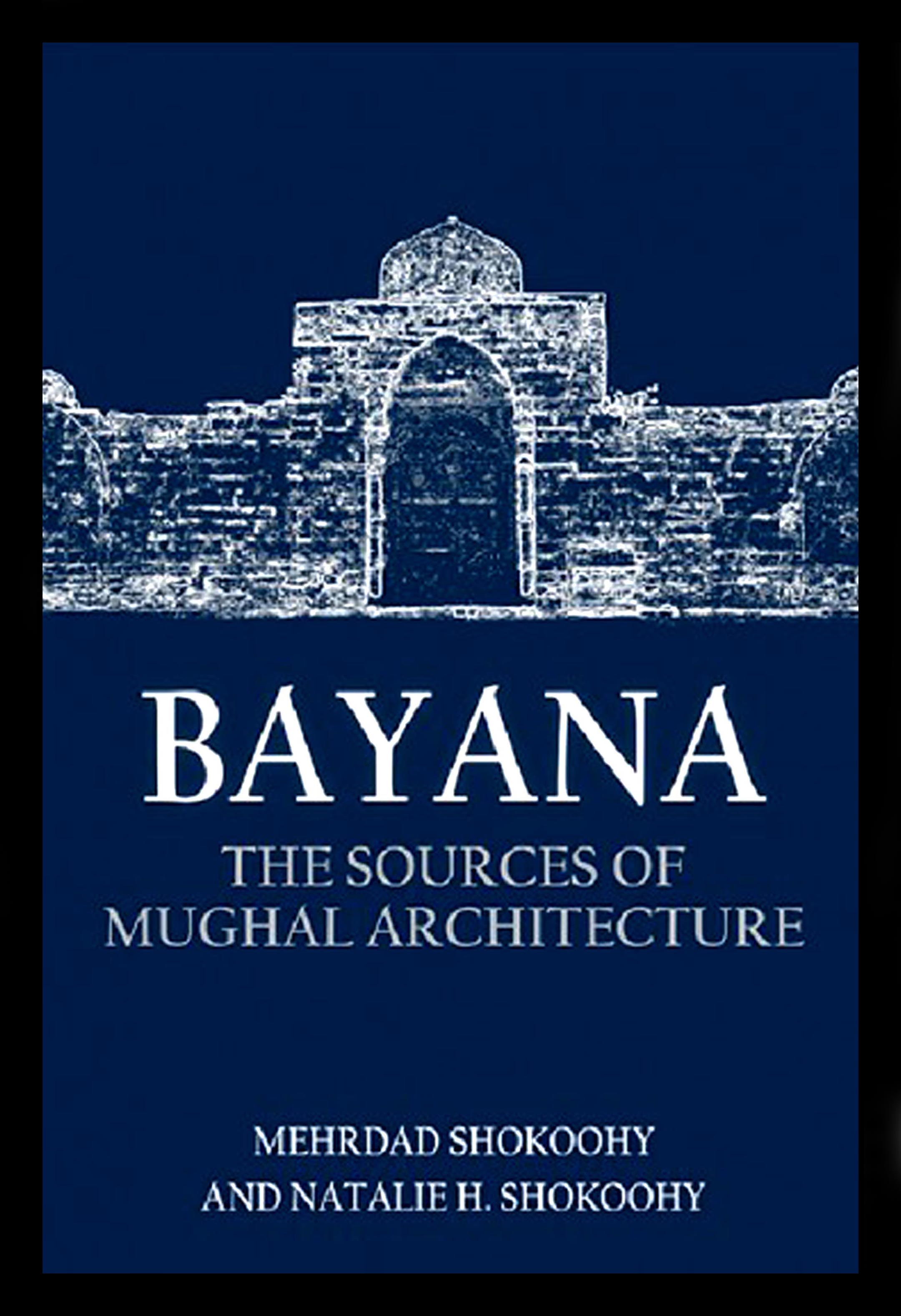
Bayana: the Sources of Mughal Architecture, Edinburgh University Press,
Islamic and Middle Eastern Studies, pp. 768 with 352 colour photographs
and 255 monochrome photographs, maps and diagrams; appendices;
bibliography; index.
ISBN 978 1 4744 6072 9 (Hardback), ISBN 978 1 4744 6075 0 (Webready PDF),
ISBN 978 1 4744 6074 3 (EPUB). In print, publication date 31 March 2020.
Bayana, were it not for its shortage of water, might have been the capital of India. Agra and Fathpur Sikri, the capitals of the mighty Mughals were once mere villages of Bayana. Situated in south-eastern Rajasthan, Bayana held a strategic position on the ancient route from Delhi to Gwalior and the Deccan, combined with an impregnable fort and natural and agricultural resources. The Moroccan traveller, Ibn Battuta, who had seen fine mosques and great cities from Cordoba to Cairo, Delhi and Khanbaliq (Beijing) visited Bayana in 1342 and found it so impressive that he called it a “great city” and its congregational mosque “one of the finest”. The mosque still stands, along with many other monuments.
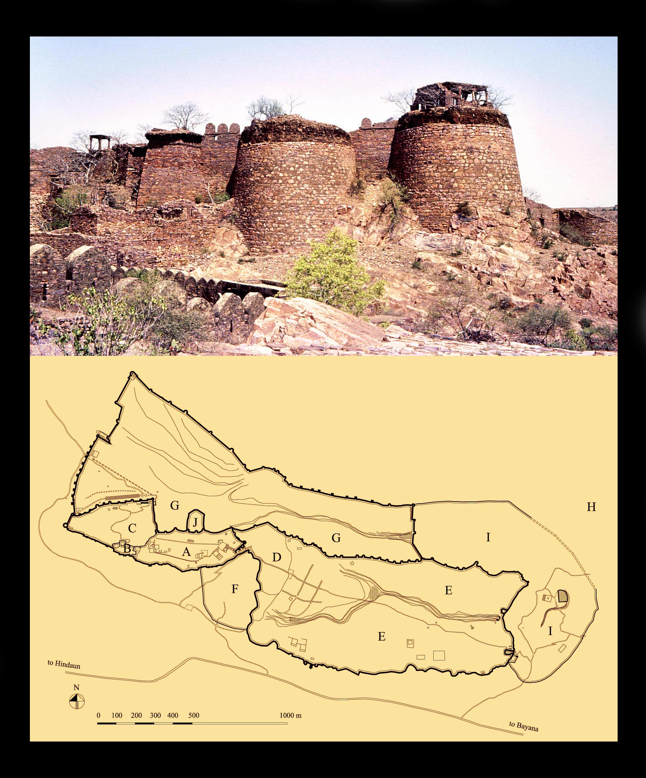
The Fort, called Tahangar, also preserves the layout of its own walled town with gates, markets, palatial dwellings, and even ordinary houses dating from the fifteenth century. To deal with the aridity of this desert region, water was harnessed for utility in reservoirs and stepwells, embellished to also provide private and public places of resort.
Between Timur’s (Tamerlane’s) invasion of Delhi in 1398 terminating the empire of the Delhi sultanate, and the rise of the Mughal empire in the mid-sixteenth century, India had fragmented into small independent sultanate states or autonomous principalities.
A corner of the impregnable fortifications of the
citadel (A in map), within the much larger Tahangar
Fort. The origin of the site is pre-Islamic, but it was
almost entirely rebuilt by the Muslims with massive
ramparts and circular towers.
In architecture, the Delhi style, which had dominated most of the northern regions was transformed during this period, and in many areas regional styles developed, some of which – such as those of the Deccan, Malwa and Gujarat – have been studied in some detail in the past, but not Bayana.
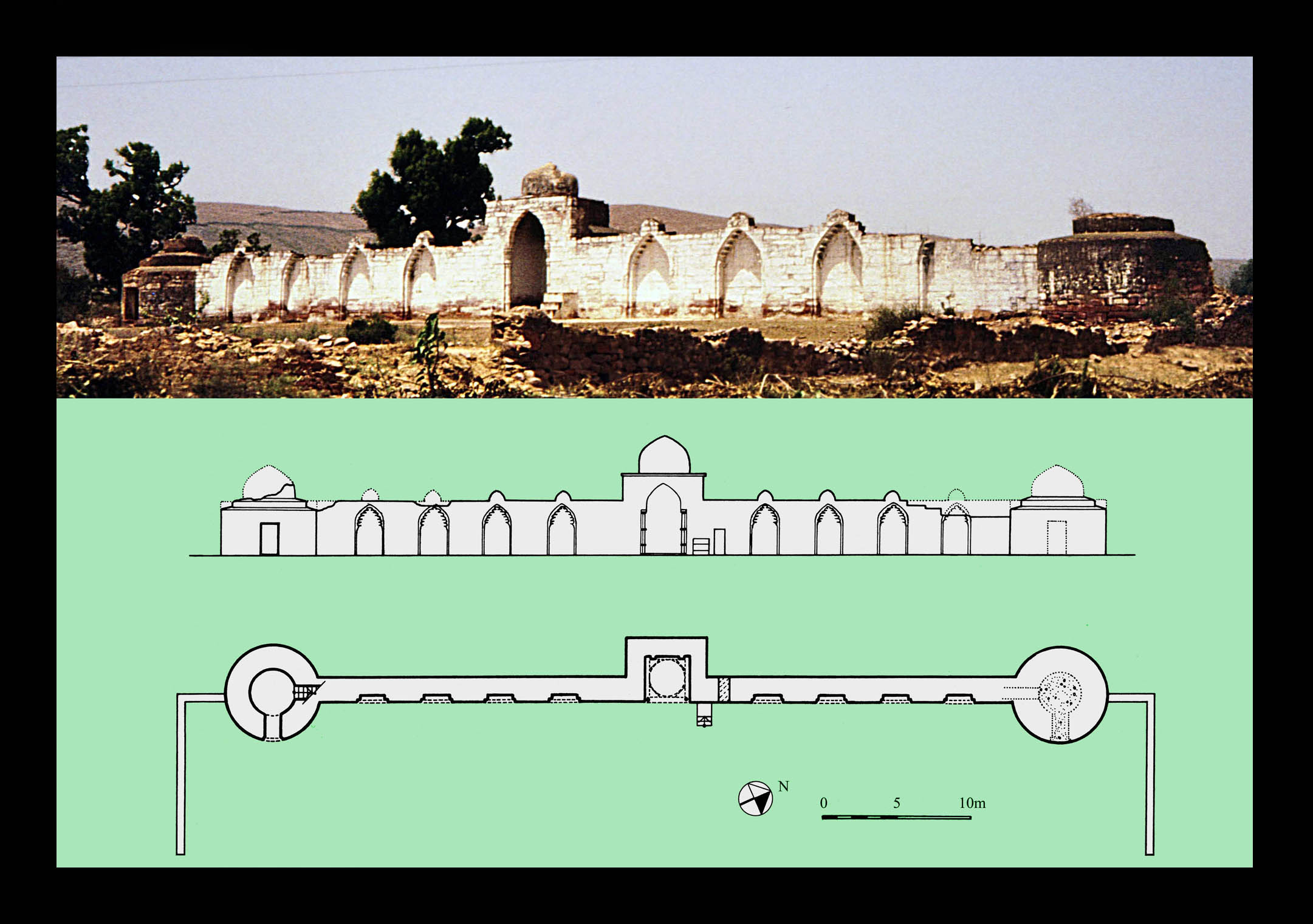
The `Idgah of Bayana, the prayer ground
for Muslim festive days, built by Baha al-din
Tughrul in the last days of the twelfth century.
It is the oldest standing structure of its kind
in India and probably the world.
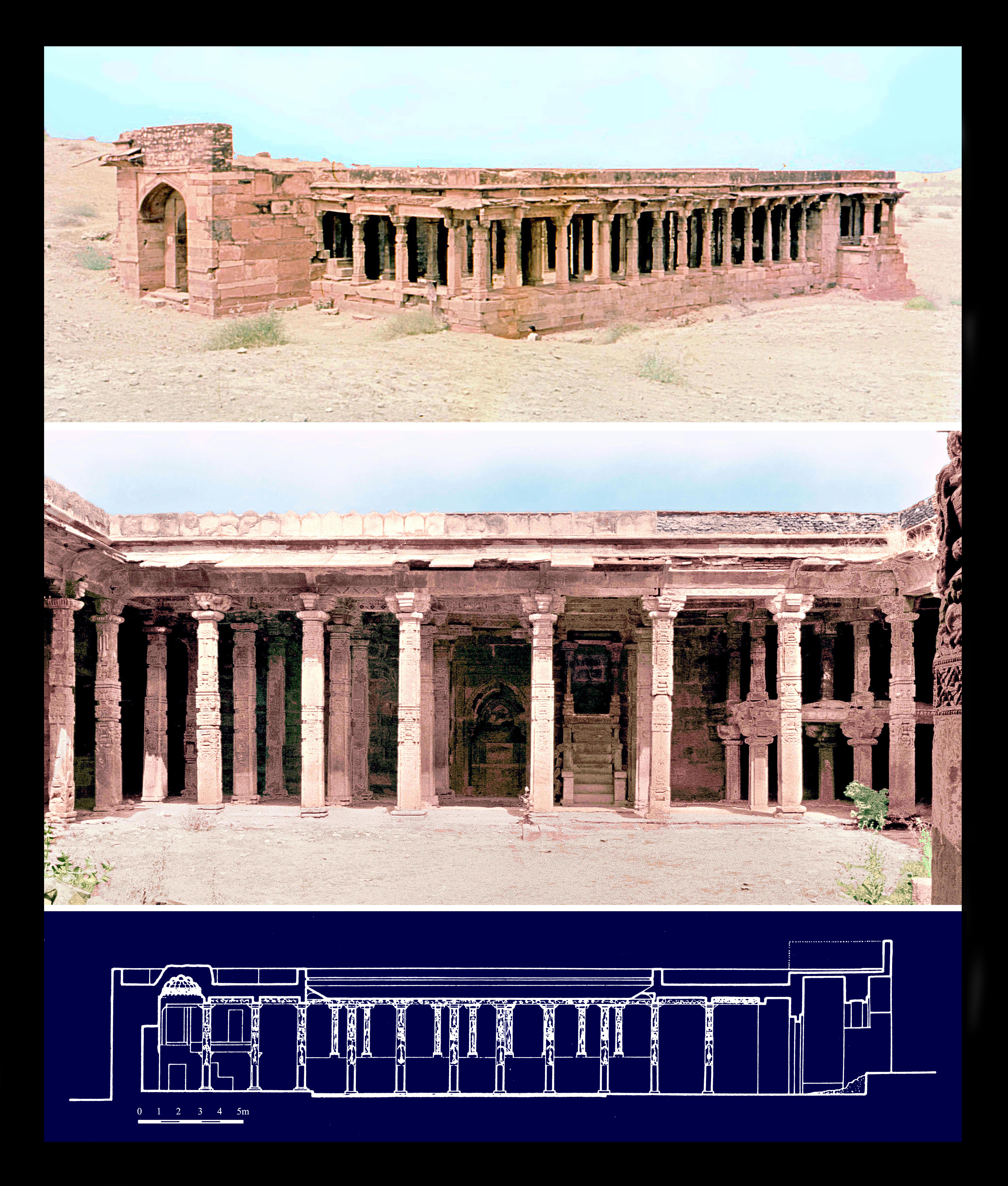
Bayana, controlled in the fifteenth century by the Auhadi family, was a key player among these states, with its formidable fort as the Auhadi’s power base. They bore the title of Khan and while not claiming to be sultans, ruled independently from Delhi and occasionally took sides with the Sharqi sultans of Jaunpur.
The Chaurasi Khamba Mosque, built at the end of the
twelfth or the first years of the thirteenth century out
of temple spoil in the northern borderland between
the territory of Bayana and Delhi. The inscription of
the mosque declares Baha al-din Tughrul as sultan.
The mosque itself has preserved most of its original
features, including its mihrab (the prayer niche marking
the direction of Mecca), the royal gallery at the right
(north) side of the prayer hall and the stone minbar or
pulpit, the oldest surviving specimen of its kind in India.
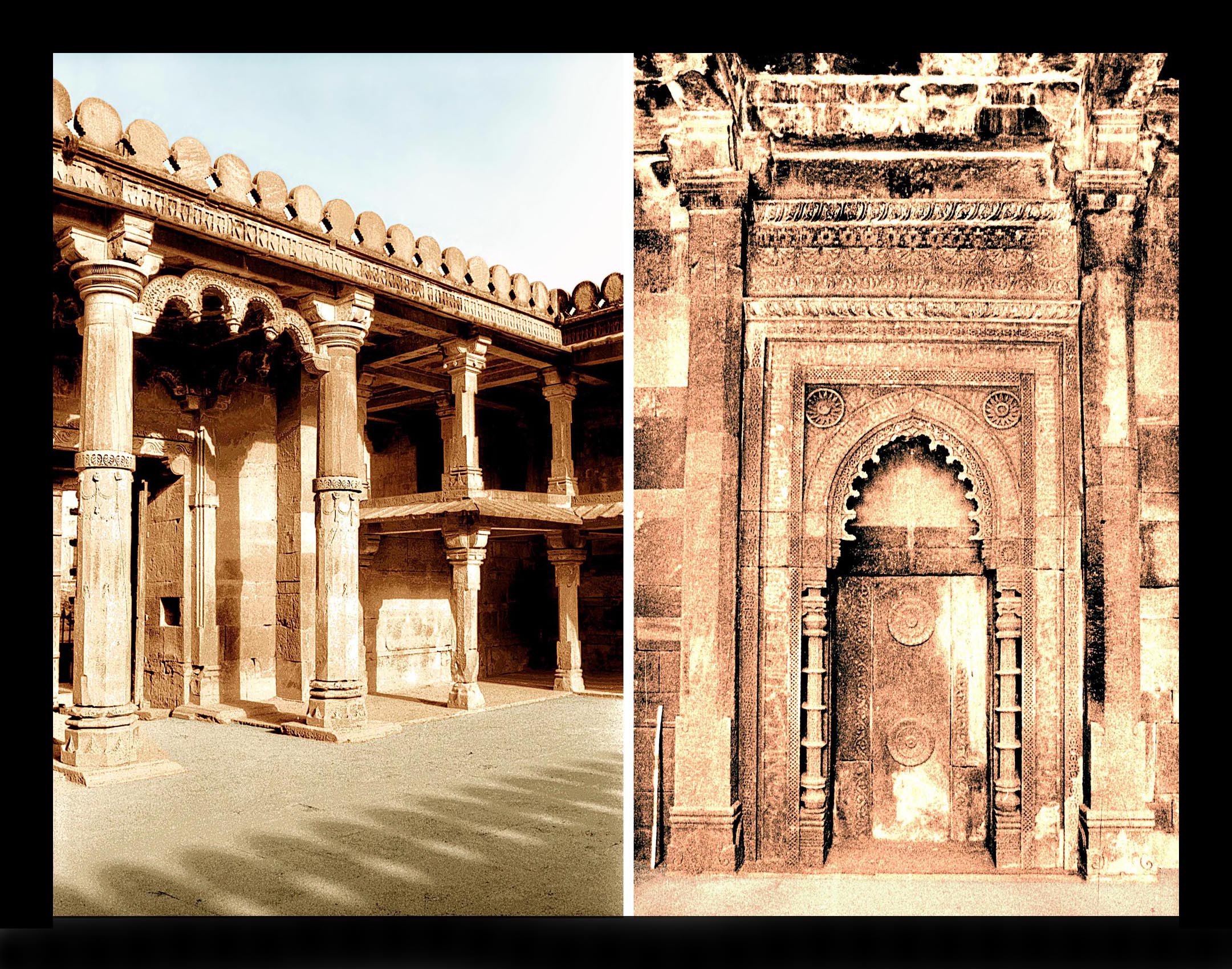
The Ukha Masjid, an extension to Baha al-din’s congregational mosque, added in 1320-21
during the reign of the Delhi Sultan Mubarak Shah Khalji. Left: the entrance seen from the
courtyard. Right: the elegant central mihrab in the prayer hall. Constructed entirely of local
red sandstone, which later was to become the hallmark of the Mughal Emperor Akbar’s
buildings, the mosque has many details which were later adopted by Mughal architects. The
subtle, well-balanced and impressive design of the mosque left a life-long impression on Ibn
Battuta who visited it only twenty-one years after its construction and remarked: “It is one
of the finest mosques, with walls and ceilings all of stone”.
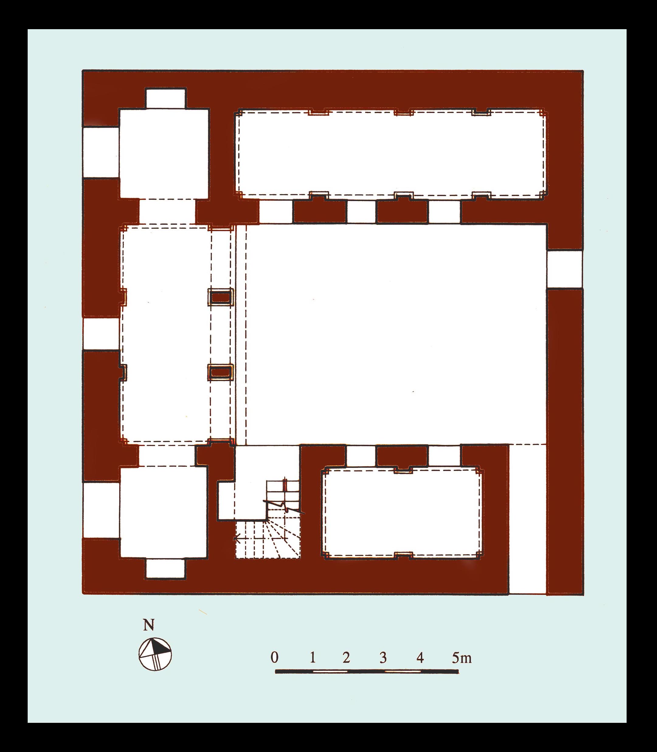
The ground plan of a house, originally in two storeys,
built in the Fort in the fifteenth century and partially
collapsed in the earthquake of 1505, when Bayana
town as well as the town in the fort were devastated
and people gradually abandoned the Fort, many
migrating to Agra, the newly developed capital of
Sikandar Lodi. This was well before the appearance
of the Mughals on the political scene of India. The
house consists of an open-fronted hall and a number
of rooms arranged around a courtyard entered via a
corridor from a single entrance. The stairs to the
collapsed upper floor are preserved at ground level.
The Auhadi’s rule came to an end after the rise of the Delhi Sultan Sikandar Lodi, who eventually took over Bayana, made it his capital and began to build a new town called Sikandra in the valley next to the fort, but abandoned it, unfinished, in favour of Agra, which, set by the River Jumna had an ample water supply. Sikandar Lodi attempted to introduce the architectural traditions of Delhi to Bayana, building a new congregational mosque in the Delhi style, but the characteristics of the local trabeate stone architecture prevailed and other Lodi monuments of Bayana are all in the local style.
A peculiarity of historic sites in India is that whole towns with outstanding remains can, through political change or climatic events, be either built over by modern developments or fall into obscurity. The latter is the case with Bayana. In spite of the many historical references to the region, epigraphic records and numerous archaeological and architectural remains, some on a grand scale, the territory and its history lack serious study.
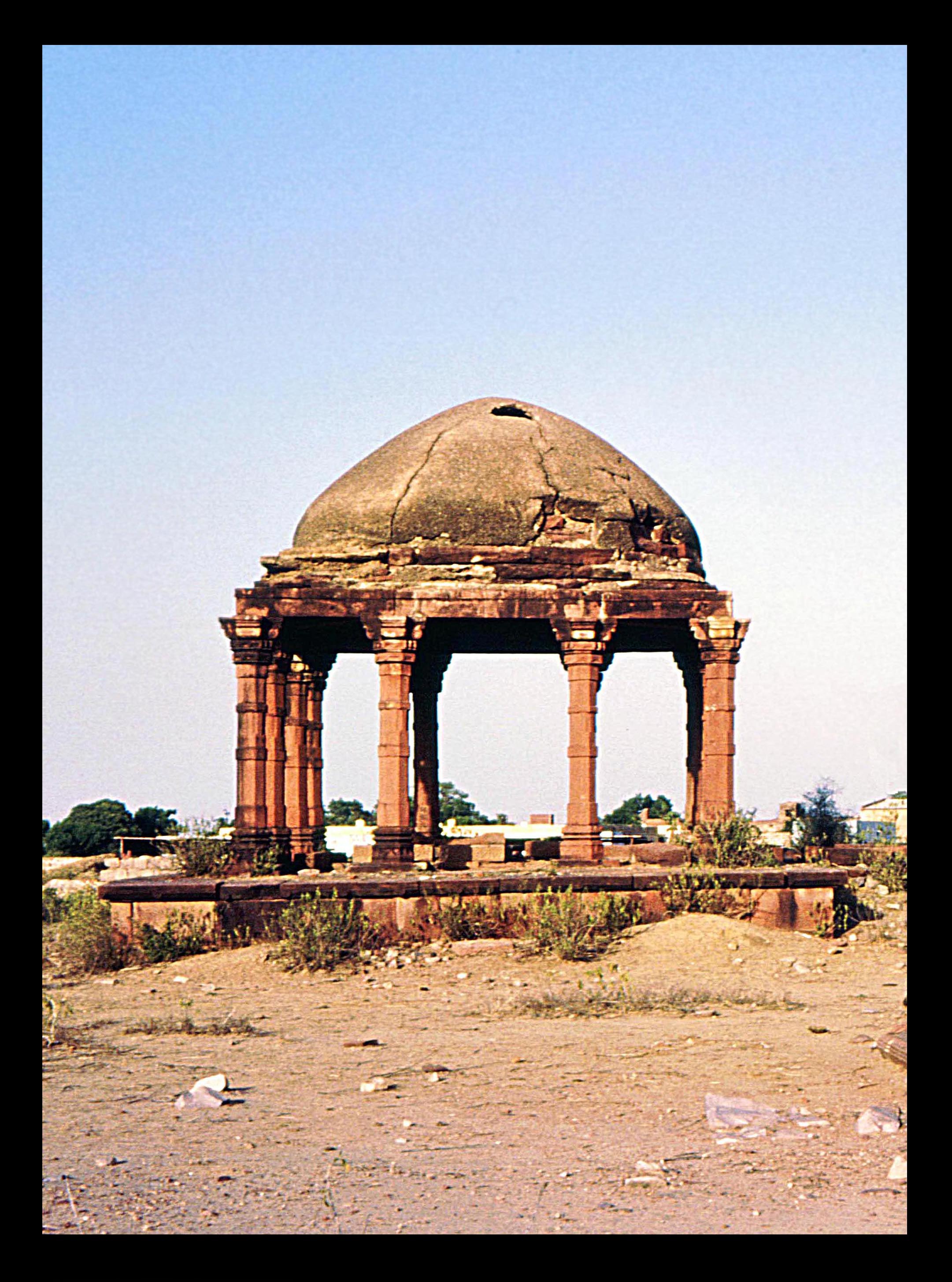
The tomb of Auhad Khan, the powerful autonomous ruler of the
Auhadi dynasty who died on Saturday 13th September 1421.
The tomb’s form, a twelve-columned chatri, or colonnaded domed
pavilion, is a common type for North Indian tombs from at least the
fourteenth century, but in Bayana chatris developed a repertoire
of their own and numerous types appear, many of which are
unknown elsewhere.
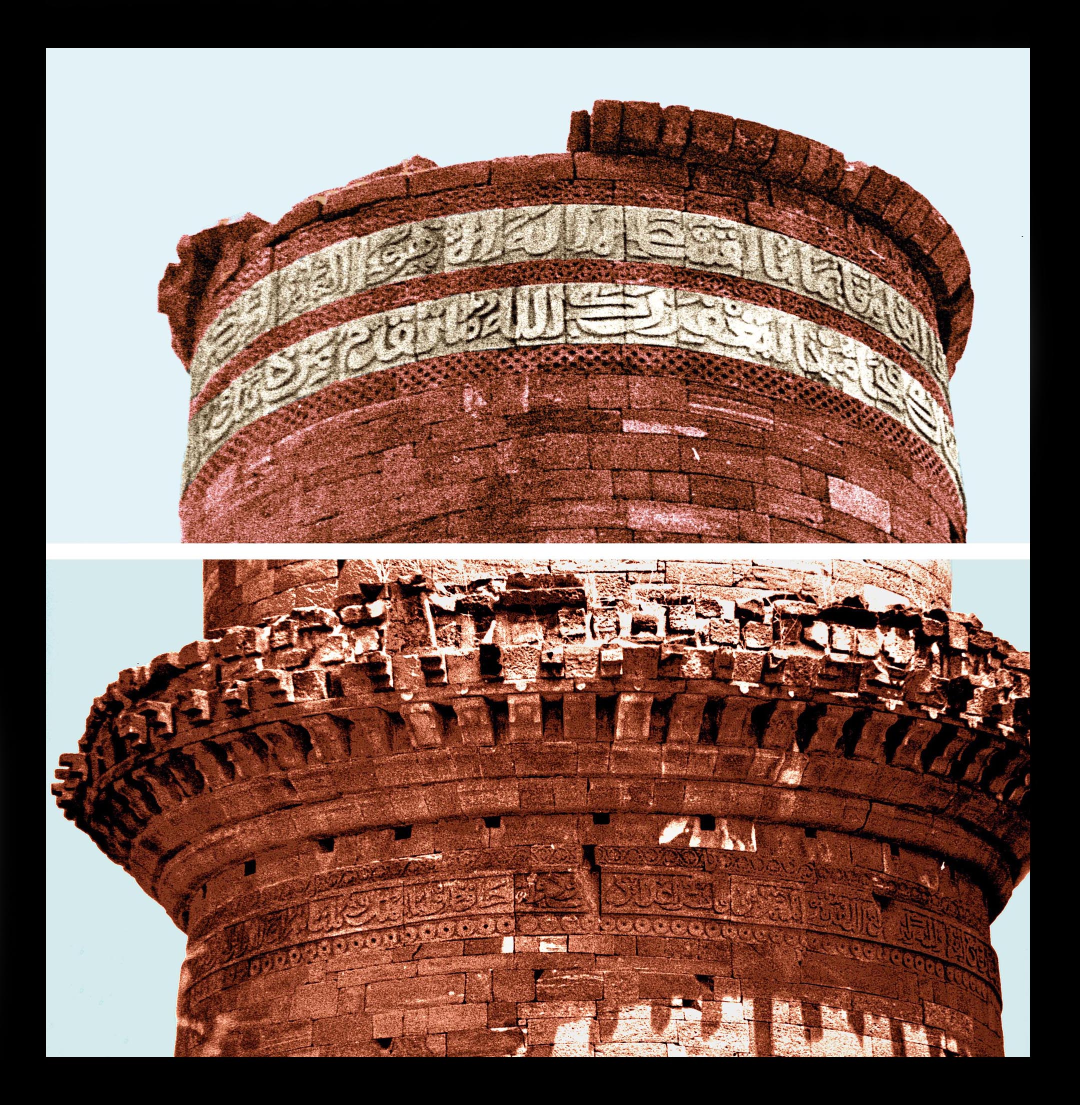
The inscriptions on the minaret of Dawud Khan Auhadi built in 1457. The upper inscription is Quranic, but the one below gives the genealogy of the Auhadi family. The numerous inscriptions in Bayana town, the fort and the entire region, all studied in this book, provide new insights into the history of the region, and its interactions with the sultanate of Delhi, otherwise hardly mentioned in histories.
The book investigates Bayana’s history, and explores the mediaeval urban planning as well as the archaeological and architectural remains of Bayana and its environs from the time of the Muslim conquest at the end of the twelfth century, up to the early Mughal period. A detailed epigraphic study considers the entire repertoire of the inscriptions in the region, with photographs and ink impressions along with fresh readings of the Arabic, Persian and Sanskrit texts and their translations. As for the historical sources, originals are given, often with fresh translations, as earlier translations tend to summarise or omit pertinent detail.
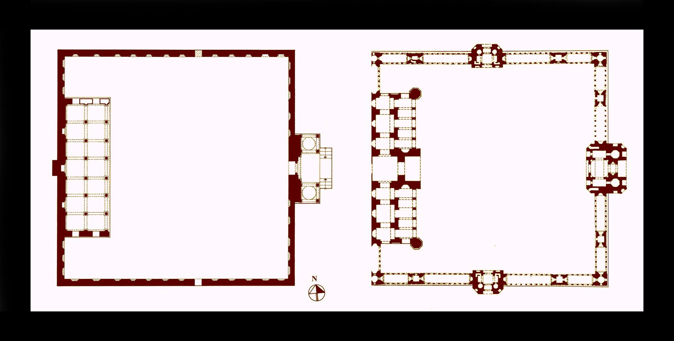
A new form of mosque plan, developed in fifteenth century Bayana, with the prayer hall
extruding into the courtyard and flanked by it. This layout had a strong influence on the
planning of Mughal mosques. Left: plan of the `Idgah Masjid, built in the fifteenth or early
sixteenth century in the village of Barambad near Bayana town, and right: plan of the
seventeenth century congregational mosque of Delhi. Bayana’s influence on Mughal
architecture goes beyond structural systems, decorative motifs and stone carving, the
whole repertoire was transplanted to the new imperial cities
The larger picture that emerges sheds light on the social affairs and even the domestic life of the period, as Bayana is exceptional in that it preserves a large number of fifteenth and early sixteenth-century domestic buildings. The analysis of the development of its built environment also demonstrates both in terms of planning and in decorative forms the extent to which early Mughal architecture was rooted in the traditions of Bayana.
Madurai, history, art and architecture, EI3, Part 2, 2019, pp. 138-146, illustrations 1-6.
Madurai a Hindu pilgrimage centre on the bank of River Vaigai, fell under Muslim rule following raids by the armies of the Khalji sultans of Delhi, `Ala al-din and Mubarak Shah followed by a short period of an independent sultanate (c. 1333 to 1378). The Moroccan traveller Ibn Battuta who visited Madurai records:
"Mathura is a large city, with broad streets. Sultan al-Sharif Jalal al-din Aḥsan Shāh… built the city to resemble Delhi… When I went to the city there was an outbreak of cholera ... The sultan … found his mother, his wife and child ill. He remained in the city for three days and then moved to the bank of the river situated one parasang from the town. At this place, there is a temple of the infidels."
_-c6278-01a,_DETAILS,_Tom_Turner_.jpg?240)
A mid-eighteenth century plan of Madura town and its immediate environ, As usual for many maps of this period the south (not the north) is orientated towards the top. The site of the Muslim quarter and the tombs of `Ala al-din and Shams al-din is shown at the bottom left.
He makes it clear that there were two Madurais: one Muslim (which could be under modern Tiruparangundram ‒ where the last Ma`bar sultan Sikandar Shah (c. 1372–1377-8) was slain by the forces of Vijayanagar), and the other Hindu ‒ by the River Vaigai with the great Sri Minaksi temple at its centre. The Hindu Madurai was, of course much older than Ahsan Shah’s new capital but the burial in the earlier town of two of the Ma`bar sultans and some of their courtiers indicate it had a Muslim community, as does the historic mosque of Qadi Taj al-din. The Hindu layout follows the concept of the town as an image of the cosmos, with a concentric plan placing the Sri Minaksi Temple at its centre with two layers of perimeter walls. In spite of modern expansions, the old core is preserved along with the straight street layout of the town, generated around the temple with its four gates opening to the four main streets aligned in the cardinal directions.
Muslim architecture of Madurai
The Muslim architecture of Madurai shares similar structural principles with that of the Hindu monuments of Tamil Nadu, all constructed with dressed stone, but in their planning the mosques have a design peculiar to South India: a prayer hall, with or without an ante-chamber, fronted by a colonnaded portico. The foremost monument is the shrine housing the tombs of the Ma`bar sultans, `Alā al-din Udauji and Shams al-dīn `Adil Shah, consisting of a square domed chamber in the centre of a colonnade two aisles deep and covered with a flat roof. The design of the plan resembles that of many tombs of Gujarat and it seems likely that the form could have been introduced from Gujarat via the Indian Ocean trade route. The dome of the central square chamber with an inner diameter of 5.9 m. appears on the exterior as a simple hemispherical dome, but it is actually a single piece of rock smoothed on the outside but with the soffit only roughly hollowed out to demonstrate the monolith. There is no other parallel with this dome in Muslim buildings in South India, but in Hindu architecture carving huge monoliths and placing them on the top of temples was a common practice.
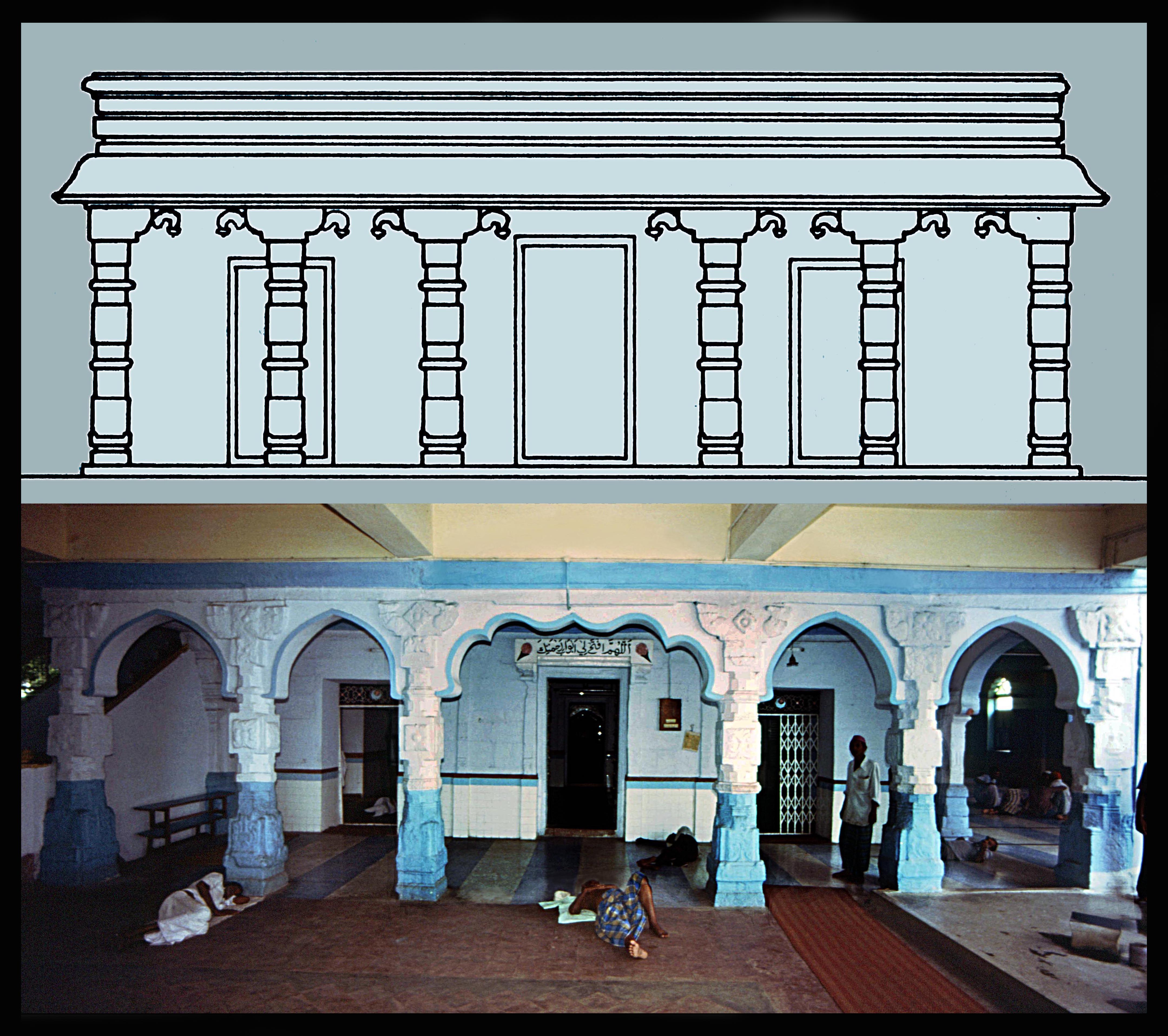
The mosque of Qadi Taj al-din, view of the eastern
entrance colonnade seen from the modern extended
hall. The lobed arches between the columns are later
additions. Above, line drawing of the east elevation
showing it in its original condition.
Among the mosques the oldest are one in the compound of the shrine of `Ala al-din and the other the mosque of Qadi Taj al-Dīn or Kazimar (Qadimar) in the town, both having the typical South Indian layout and without a formal courtyard. The Qadi Taj al-din mosque was extended in the 1970s as the congregational mosque (Jami`) obscuring the original core which is, however, preserved without alteration. It is believed locally that the mosque was founded by Taj al-din (d. 692/1292-3), but the present building seems to date from the Vijayanagar period. It consists of a colonnaded porch, opening via an ante-chamber to the prayer hall. The monolithic columns are elaborately decorated and their bracket-capitals follow the traditional Hindu and Muslim South Indian design. The single mihrab (prayer niche) is square in plan and has a slightly ogee three-lobed arch, which derives from a profile seen in numerous early mosques of both North and South India.
The ante-chamber leading to a prayer hall seen in this mosque and many others in South India never appears in North India. This layout may have been introduced from the coastal regions of the Middle East where such features could be seen in a ruinous 10th or 11th century mosque at Siraf, south Iran and in some 12th century mosques in the Yemen. If the shrine of `Ala al-din displays architectural influence from Gujarat, the appearance of ante-chambers in the mosques of Madurai and elsewhere in South India is material evidence of the cultural relationship of the region with Middle Eastern centres of maritime trade.
Kochi (Cochin), history, art & architecture, EI3, Part 2, 2019, pp. 116-122, illustrations 1-4.
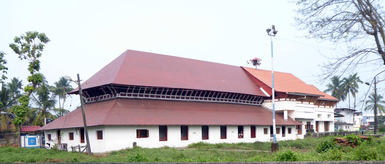
Cochin, the historic Jami` mosque also known as Chembattapalli, burnt to the ground by the Portuguese and rebuilt entirely in 1519-20.
Cochin, renamed Kochi (Kerala, India), well-known for its Jewish settlement, also has a rich Muslim heritage. The history of the town goes back only to after 1341 when a geological event re-shaped the coastline with old Cochin being submerged under water and the island of Vypin emerging from the sea, heralding a new era, Puduvaipu, used for dates in many records. The ancient town was an insignificant port, ignored by the early merchants and the Moroccan traveller Ibn Battuta, who passed the site of old Cochin early after its destruction but does not mention the present town, which was not yet established, although he visited the Jewish settlement above a hill – apparently un-affected by the catastrophe.
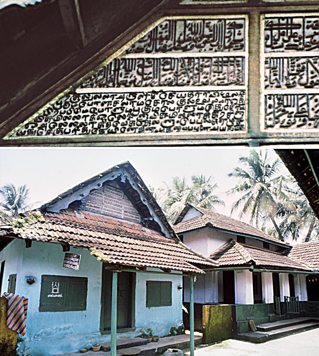 The new town developed probably by the end of the 14th century along the calm backwater which formed an excellent harbour and the town entered the geopolitics of the time when, in 1500, its Raja made an alliance with the Portuguese. At the time Cochin was still a small town with the Raja’s palace, according to the Portuguese, a humble structure, badly furnished and the townspeople living in houses with mud walls and timber roofs. However, the Muslim merchants (the “Moors”) lived in grander dwellings enclosed by stone walls to protect their merchandise. The Jews and Muslims were under the Raja’s protection and in spite of the Portuguese hostility to these communities they were obliged to tolerate them. The Muslim who were importers of rice (the staple diet of South India) retained their position and traded not just with the local people but also with the Portuguese, who nonetheless destroyed a mosque on the coast which was later rebuilt and still stands today. The new town developed probably by the end of the 14th century along the calm backwater which formed an excellent harbour and the town entered the geopolitics of the time when, in 1500, its Raja made an alliance with the Portuguese. At the time Cochin was still a small town with the Raja’s palace, according to the Portuguese, a humble structure, badly furnished and the townspeople living in houses with mud walls and timber roofs. However, the Muslim merchants (the “Moors”) lived in grander dwellings enclosed by stone walls to protect their merchandise. The Jews and Muslims were under the Raja’s protection and in spite of the Portuguese hostility to these communities they were obliged to tolerate them. The Muslim who were importers of rice (the staple diet of South India) retained their position and traded not just with the local people but also with the Portuguese, who nonetheless destroyed a mosque on the coast which was later rebuilt and still stands today.
With the decline of Portuguese maritime supremacy, the Dutch took over their fort, but in the power struggle with the Nawwabs of Maysor, first Haidar `Ali, and then his son Tippu Sultan, took control of Cochin and in 1789 even proposed to buy the fort, but the Dutch declined. Tippu's final defeat by the British also eliminated Dutch control and in 1796 they eventually transferred the fort to the British.
Cochin, below, Shrine of Zain al-din al-Ma`bari with
its mosque in the background photographed in 1994.
On the gable of the shrine the inscribed wooden panels
can be seen, but they have since been dismantled and
sold to private collectors. Above details of the inscription
in Malayalam and Tamil dated 1625.
From this time the Muslim population increased and while the Jews migrated to Israel the Muslim community has continued to flourish and has now spread out of their traditional neighbourhood to all parts of the town.
Architecture: In Cochin the old street layout of the Jewish and Muslim quarters has been preserved, with the Muslim institutions along the spinal Darussalam (dar al-salam) Road, including the shrine and mosque of Zain al-dīn, and the historic Shafi`i Jami`, also known as Chembattapalli, which is known for its wooden structure and details. The outer walls are of stone, but the columns and the entire two-tiered roof structure are of wood. The prayer hall is entered through a colonnaded entrance porch which bears a bilingual inscription of 1519-20 incorporating the phrase “endure the fire” alluding to its reconstruction after being apparently burnt by the Portuguese some two decades earlier. An old addition to the building is a chamber housing an ablution pool, but in recent decades the mosque has been extended extensively at the front of the porch. The original wooden upper structure is a large, well-ventilated, slightly dark hall with a high ceiling, once used as a madrasa (theological college). The building’s joinery is simple but the structural elements fit ingeniously together to support each other in equilibrium; a well-attested method, centuries old.
Near the mosque is a chamber housing the tombs of two local religious personages: Sayyid Isma`il and Sayyid Fakhr al-din Bukhari, and further away is the shrine and mosque of Zain al-dīn al-Ma`bari. These small buildings, while not as striking architecturally, are revered locally. The Shrine of Zain al-din had, until 1994, inscribed wooden panels on its gable (now dismantled and apparently sold to private collectors) in Arabic, Malayalam and Tamil text dated 1625 and another inscription dated 1591-2 over the interior of the entrance of the mosque which seems to refer to its construction. The shrine is also significant for being the tomb of the ancestor of the better-known Zain al-din, the author of the Tuhfat al-Mujahidin, the history of the Muslim maritime merchants’ struggles with the Portuguese.
"Kozhikode (Calicut), history, art and architecture", EI3, Part 1, 2019, pp. 132–138, illustrations 1-3.
Kozhikode, better known as Calicut (Kerala, India) is known in history for its old established and resilient Muslim community whose alliance with the region’s powerful Hindu Rajas (Zamorin of the Portuguese and Samiri of the Muslims) left commerce firmly in the hands of the Arabs and the Persians, as described by many travellers such Ibn Battuta in the 14th century, Nicolò de’ Conti in the early 15th, and `Abd al-Razzaq in the mid-15th century who mentioned that the Muslims were mainly Shafa`i and had two congregational mosques (Jami`), an unusual tradition still current. Calicut’s commercial fame attracted the Portuguese who challenged Muslim dominance, and created a long period of hostility between the two.
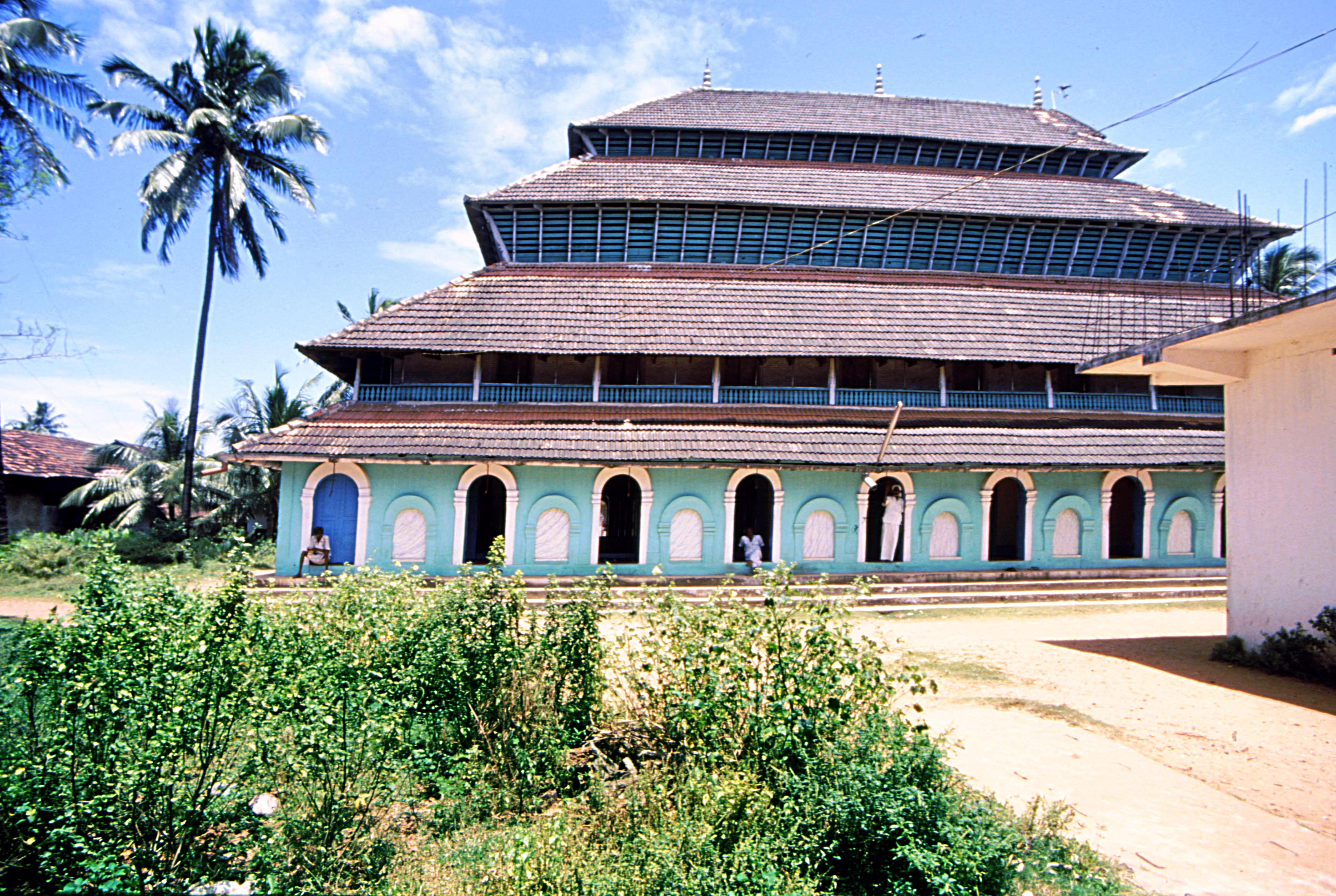 At first, in 1498, the Muslims blocked Vasco da Gama’s attempts at setting up a trading post and two years later, in his second voyage, when negotiations failed the Portuguese shelled the town, burned the houses and the main congregational mosque, but were at the end defeated ‒ with the mosque being rebuilt even grander than before. However, with the growing marine supremacy of the Portuguese armada many Arabs and Persians gradually left the scene, and the Muslim global trade, based on peaceful free enterprise, came to a virtual end. In the course of time the Muslims, now many of local origin, remained strong, rebuilt their edifices and today live in many parts of the region as well as in the core of the old port, making up almost half of the population of Calicut. At first, in 1498, the Muslims blocked Vasco da Gama’s attempts at setting up a trading post and two years later, in his second voyage, when negotiations failed the Portuguese shelled the town, burned the houses and the main congregational mosque, but were at the end defeated ‒ with the mosque being rebuilt even grander than before. However, with the growing marine supremacy of the Portuguese armada many Arabs and Persians gradually left the scene, and the Muslim global trade, based on peaceful free enterprise, came to a virtual end. In the course of time the Muslims, now many of local origin, remained strong, rebuilt their edifices and today live in many parts of the region as well as in the core of the old port, making up almost half of the population of Calicut.
Calicut, the fourteenth century Mithqalpalli, with the timber upper
structure of the mosque reconstructed in the sixteenth century.
The two lower tiers follow traditional structural principles, but the
two upper tiers are set back successively to create the imposing
four-tiered appearance of the mosque, which is the most impres-
sive of all Muslim structures in Malabar.
The old Muslim quarter, known as Kuttichira, at the south-east of the modern town, occupies an area surrounding the historic tank and town square, still a gathering-place. To its north-east stands the imposing Mithqalpalli, the congregational mosque constructed originally in the 14th century by Nakhuda Mithqal, a wealthy ship-owner and merchant. This is the mosque that the Portuguese burned in 1510 and was reconstructed in c. 1578-9. The prayer hall and ante-chamber are at ground level, constructed with stone walls with arched doors all around, and surmounted by a grand timber roof in four tiers housing three upper floors supported by a combination of stone walls and wooden columns. At the northern side of the ante-chamber, a chamber housing an ablution chamber has been added later.
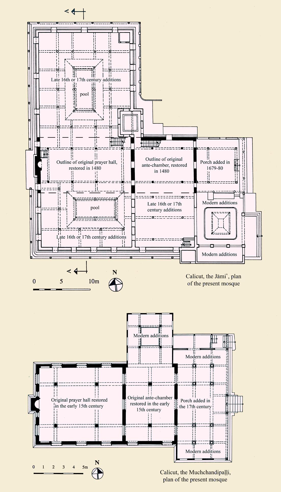 In the Mithqalpalli the single prayer niche (mihrab) has a deep semi-circular plan and a semi-circular arched profile decorated with foliations jutting out of the frame at the sides and the crown, unfamiliar in Indian and Middle Eastern architecture, but similar to motifs seen in the 15th-century tombstones of Malaysia, indicating widespread links in maritime arts and architecture. The mosque has also retained its old wooden pulpit (minbar) bearing a number of Arabic inscriptions recording the dates of renovations, the earliest carried out in the first decades of the 17th century on the order of the Port-master, Jamal al-din `Antabi, apparently from Entebbe in Uganda. In the Mithqalpalli the single prayer niche (mihrab) has a deep semi-circular plan and a semi-circular arched profile decorated with foliations jutting out of the frame at the sides and the crown, unfamiliar in Indian and Middle Eastern architecture, but similar to motifs seen in the 15th-century tombstones of Malaysia, indicating widespread links in maritime arts and architecture. The mosque has also retained its old wooden pulpit (minbar) bearing a number of Arabic inscriptions recording the dates of renovations, the earliest carried out in the first decades of the 17th century on the order of the Port-master, Jamal al-din `Antabi, apparently from Entebbe in Uganda.
The other congregational mosque in its present form is the largest mosque of Calicut, but was originally a much smaller building chosen as the Jami` after the burning of the Mithqalpalli, and enlarged later. The mosque and its minbar bear many inscriptions, the oldest, referring to an early restoration dating from 885/1480-81. Another records the addition of a porch in 1679-80 by a shipmaster, Shaikh `Imad who in 1683 also restored its elegant minbar. The mosque is entered via the porch, opening to an ante-chamber which in turn leads to a large prayer hall. The plan is not much different from that of the Mithqālpaḷḷi and other mosques of the town, but its proportions and asymmetrical layout – the result of the extensions and alterations – make it unlike other mosques of South India. A feature of the mosque are two rectangular pools inside the prayer hall, with openings in the roof to allow light for the hall and rainwater to pour into the basins, creating a pleasant cool interior environment, an architectural innovation with no ritual function.
Calicut, present plans of the two oldest mosques in the
town the Jami` (above) and Muchchandipalli (below).
The remains of the layout of the original walls are shown
in solid black and later additions in line drawing.
Near the mosque is another smaller mosque, the Muchchandipalli which is probably the oldest in Calicut, bearing a foundation inscription which seems to date from 1287-8. Another records its renovation in c. 1480-81. The structure’s stone walls have semi-circular arched doors similar to those at the Mithqalpalli. The decorated porch is close in form to that of the Jami` and from the same period. The wooden upper level is similar to that of the Jami` but has been partly reconstructed in later dates, giving the façade a three-tiered appearance. A number of smaller mosques in Kuttichira are all built on the same principle of stone walls with wooden columns and roof structure, and altogether Calicut’s Muslim edifices represent the best of Kerala’s rapidly disappearing architectural traditions, with the Mithqalpalli, still the grandest mosque in South India.
* “The Lady of Gold: Sikandar Lodi's mother (c. 837/1433 - 922/1516)
and the tomb attributed to her at Dholpur, Rajasthan”,
M. and N. H. Shokoohy, BSOAS, vol. 81, Part 1, 2018
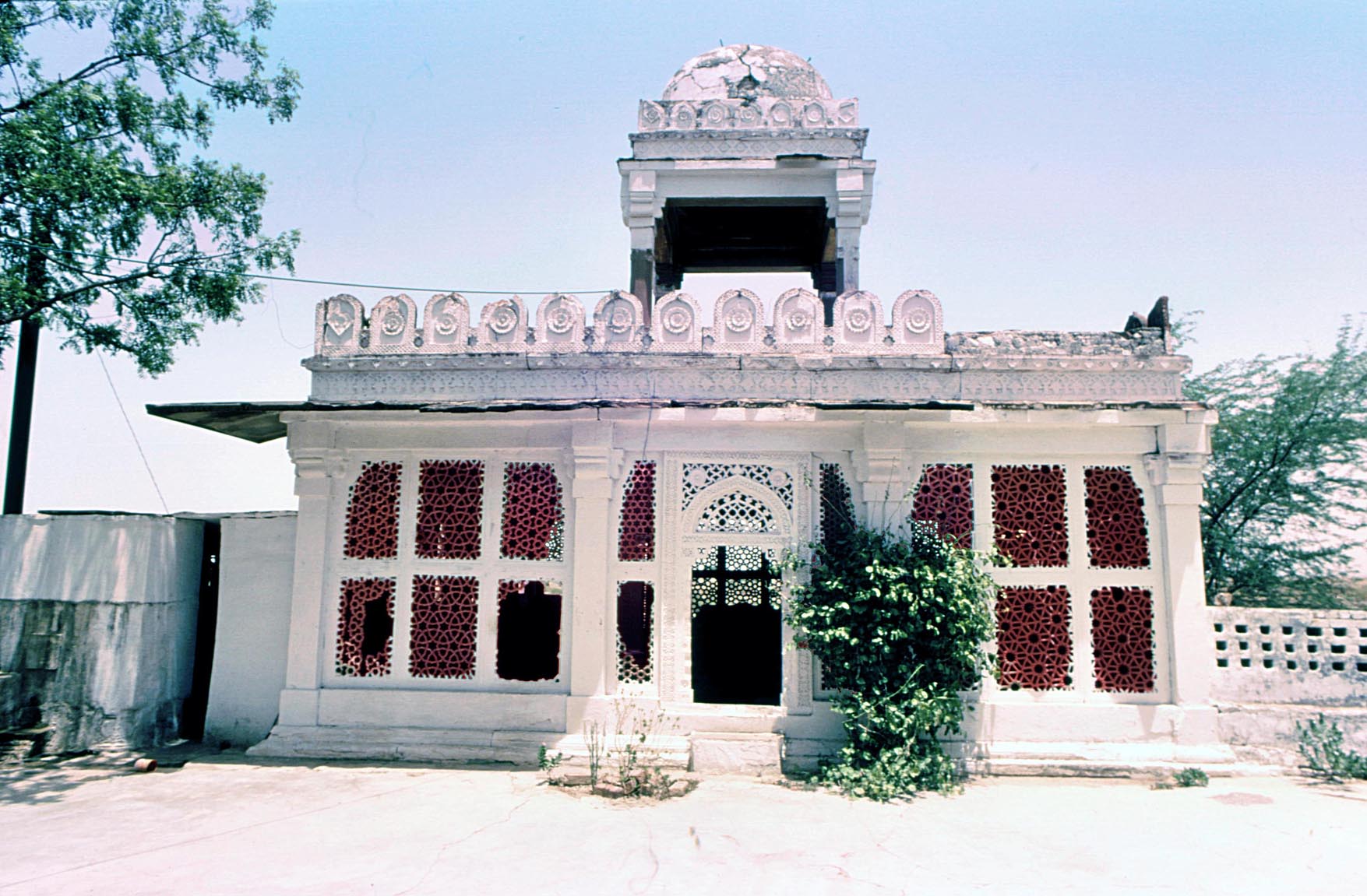
“It is said that in the days that Bahlul Khan was Governor of that town (Sirhind or Sihrind) he had built outside the fort a mansion comparable to the heavenly paradise. Sometimes he resided there. In those vicinities lived a goldsmith who had a daughter with a face like a tulip and hair the colour of musk; it happened that Bahlul’s eye fell upon her, he was enchanted. That beauty with moon-like face also gave her heart to him. When he sat on the royal throne he satisfied the wishes of her father and married her.” This was Sikandar Lodi’s mother as described by the Tarikh-i Shahi.
Until the Mughal period historians of Muslim India hardly mention ladies, as it was considered discourteous, while in any case only a handful of noble women were deemed worthy of mention. A secluded lady was of concern only to the man of the house. But a few women’s influence reached beyond the harem and their voices appear between the lines. One was Sultan Raḍiya, Īltutmish’s daughter, who succeeded to the throne and enjoyed a degree of freedom during Turkish rule in India, but was killed, accused of an illicit relationship with a black slave. Another was the Sharqī Sultan Muḥammad’s mother, Bībī Rājī, who played a significant role in the affairs of Jaunpur, but this article concerns Sultan Sikandar Lodī’s mother, known as Bībī Zarrīna “the Lady of Gold”, who defied the Lodī nobility to put her son on the throne. Here we explore her story and study her tomb.
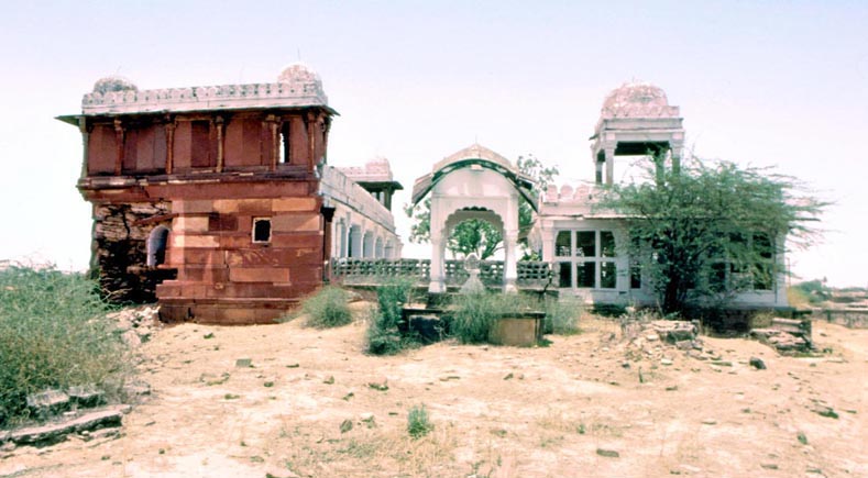 The handsome and elaborate tomb of Bībī Zarrīna faces a mosque, both built of red sandstone with the trabeated structure typical of the Bayana region. Unlike the Sayyid and Lodī buildings of Delhi, deriving from Tughluq architecture and often incorporating arcuate structures set on monolithic columns, in the Bayana region all major Lodī buildings are trabeate. A unifying design for the complex is expressed in the beam and bracket structure of the mosque and the tomb, but there are subtle differences in detail. The columns of the tomb are plain, but on the exterior between the columns pierced stone screens carved with a variety of interlaced patterns give a particular charm to the interior when patterns of light and shade fall on the floor and the tomb. The handsome and elaborate tomb of Bībī Zarrīna faces a mosque, both built of red sandstone with the trabeated structure typical of the Bayana region. Unlike the Sayyid and Lodī buildings of Delhi, deriving from Tughluq architecture and often incorporating arcuate structures set on monolithic columns, in the Bayana region all major Lodī buildings are trabeate. A unifying design for the complex is expressed in the beam and bracket structure of the mosque and the tomb, but there are subtle differences in detail. The columns of the tomb are plain, but on the exterior between the columns pierced stone screens carved with a variety of interlaced patterns give a particular charm to the interior when patterns of light and shade fall on the floor and the tomb.
The contrast between the delicate tomb and the more massive and plain mosque leads the eye from one feature to another. The modest scale of the compound also seems intentional, as it suits the mother of a king, leaving a grander design for the tomb of the sultan himself, buried in Delhi. But there may have been another reason for the chosen scale. If the mausoleum were much larger it could not have been as light as it is and the balance between the size of the building and the finely carved screen work would have been lost. As it is, the chamber with its fine open work echoes the form of an ornamental jewel box; a suitable form, perhaps, for the daughter of a goldsmith, and within it the jewel – the mortal remains of “the Lady of Gold”.
"Kayalpatnam: history and architecture", EI3, 2018, pp. 135–143, illustrations 1-3
Kayalpatnam (the “City of Kayal”, Tamil Nadu, India) is renowned in the history of the Indian Ocean maritime trade and is still inhabited by Muslims of Middle Eastern origin. The town is the site of the port of Qa’il and was visited by Marco Polo in c. 1293 who called it Cail, noting that ships from the islands of Hurmuz and Kish in the Persian Gulf, laden with horses and from Aden and Arabia, anchored there with other merchandise for sale. The town was a major port of the Coromandel Coast known to the Muslims as Ma`bar (“the pass”) and from the thirteenth century the commerce of the region was in Muslim hands, with its governor one Malik Taqi al-din al-Tayyibi, a relative of the rulers of South Iran and a minister of the Hindu ruler of Ma`bar. In this port Chinese merchandise was exchanged with goods from the Middle East and even Europe. The local products, particularly pearls, fine red silk and aromatic roots were exported, but the main import was horses, over 11,000 a year sold to the kingdoms of South India.
Although Ma`bar was taken by the army of the Delhi Sultans `Ala al-din Khalji in 1310-11 whose rule was followed by a short-lived sultanate which probably included Qa’il in its jurisdiction, the merchant community of the town remained aloof from politics and maintained its international trade, exporting local products, particularly gemstones and pearls which were gradually replacing the import of horses. The fame of the pearl fisheries lured first the Portuguese and later the Dutch who depleted the oyster beds ending the fame of Kayalpatnam. Today Kayalpatnam is a small but expanding and prosperous town with its Muslim population living in harmony with their Hindu and Christian neighbours.
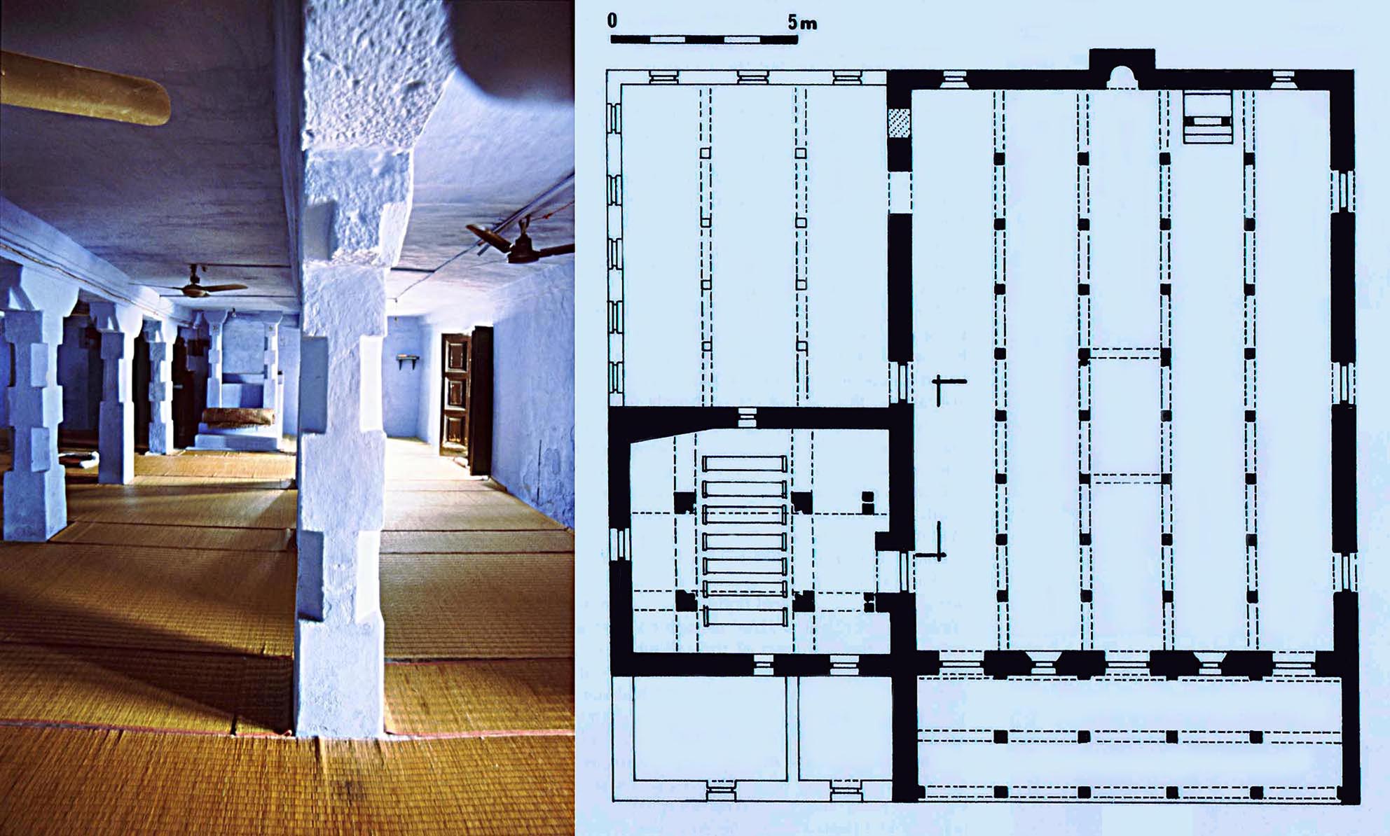
Kayalpatnam, Jami` al-Saghir or Khutba Sirupalli, the oldest mosque in the town, dating back probably to the thirteenth century. Interior and plan which also shows a tomb chamber attached to the mosque. Among the seven early fifteenth-century tombs in the chamber one dates from 806/1403. In the plan recent additions on either side of the tomb chamber are given with lighter lines.
The town has preserved a large number of historic edifices mainly constructed of ashlar, with flat stone roof slabs, some echoing the timber roof structures which were once abundant in the region, but now rare. The mosques follow the Arab tradition of having a single prayer niche (mihrab) rather than the multiple mihrabs seen in North India. Vaults and arches, common elsewhere, are not employed, instead, a covered colonnaded prayer hall with a porch is the norm. The oldest buildings are the two congregational mosques (Jami`) known as the Khutba Parriapalli or the Jami` al-Kabir (the greater Jami`) dated 737/1336-7 and the Khutba Śirupalli or the Jami` al-Saghir (the smaller Jami`). Both share a similar plan, with plain and bold structural details. Other smaller mosques have a similar layout and structural features, comprising a prayer hall with a colonnaded entrance porch at the east.
Certain new concepts of design were introduced in the seventeenth-century, best manifested in the Rettaikulampalli, a mosque which while it preserves the colonnade principle, accomplishes a wider central nave by means of elaborate multiple brackets supporting flat roof slabs of the maximum length permitted by the properties of the stone. Domes only appear in the nineteenth century, one added in the centre of the Jami` al-Kabir and another over the circular Mahlara mosque built in 1288/1871 in the Qadiriya Madrasa. Three old tomb chambers preserved in the town also display the form of the earlier widespread timber buildings. They are rectangular in plan, and while constructed entirely of stone, have hipped roofs imitating the timber roofs still characteristic of Kerala.
 * “Sources for Malabar Muslim Inscriptions”, M. Shokoohy, * “Sources for Malabar Muslim Inscriptions”, M. Shokoohy,
in: Malabar in the Indian Ocean: Cosmopolitanism in a Maritime Historical region,
ed. Mahmood Kooria and Michael Naylor Pearson, Oxford University Press,
New Delhi, 2018, 1-63, figs 1.1-1.27.
ISBN-13: 978-0-19-948032-6
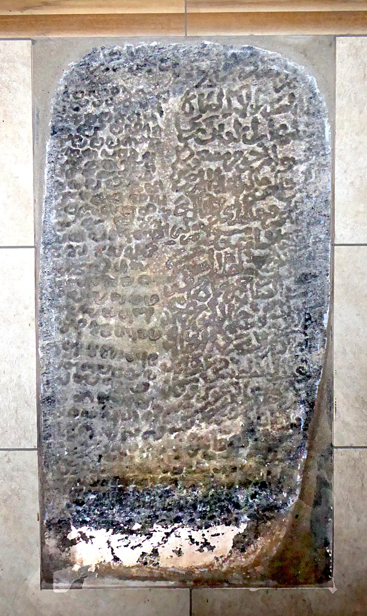
Calicut, the foundation stone of an early mosque preserved in the Muchchandipalli recording the construction of a mosque and the excavation of a well. The panel is likely to date from the thirteenth or early fourteenth century and while the date is eroded a reading of 686/1287–8 may be suggested.
As with all regions of South Asia, the inscriptions of Malabar stand as incontrovertible historical records, as, unlike manuscripts, they are not subject to error or misinterpretation of ambiguous words by later copyists. The epigraphs speak to us directly from the time of composition, setting out the composers’ aims and perception of their social position as well as revealing the community’s attitude to itself and outsiders. The Malabar maritime Muslims were a small, but affluent, influential, minority and their inscriptions often include both historical and religious texts, recording dates, sometimes events, and usually the name of the patron of the project. With epitaphs the historical text usually provides the date of an event or the death of the deceased, with names sometimes comprising a lineage, indicating position in society as well as the town or region of origin. Such information is revealing for understanding the composition of the communities.
The major inscriptions in Quilon (Kollam), Calicut (Kozhikode) and Cochin (Kochi) are investigated in detail, analysing their significance. Some inscriptions provide material evidence for the presence of Muslim communities at least from the 13th century while others attest to the revival of Muslim influence in the region, after an interruption caused by the advent of the Portuguese in the Indian Ocean and their challenge to Muslim maritime trade.
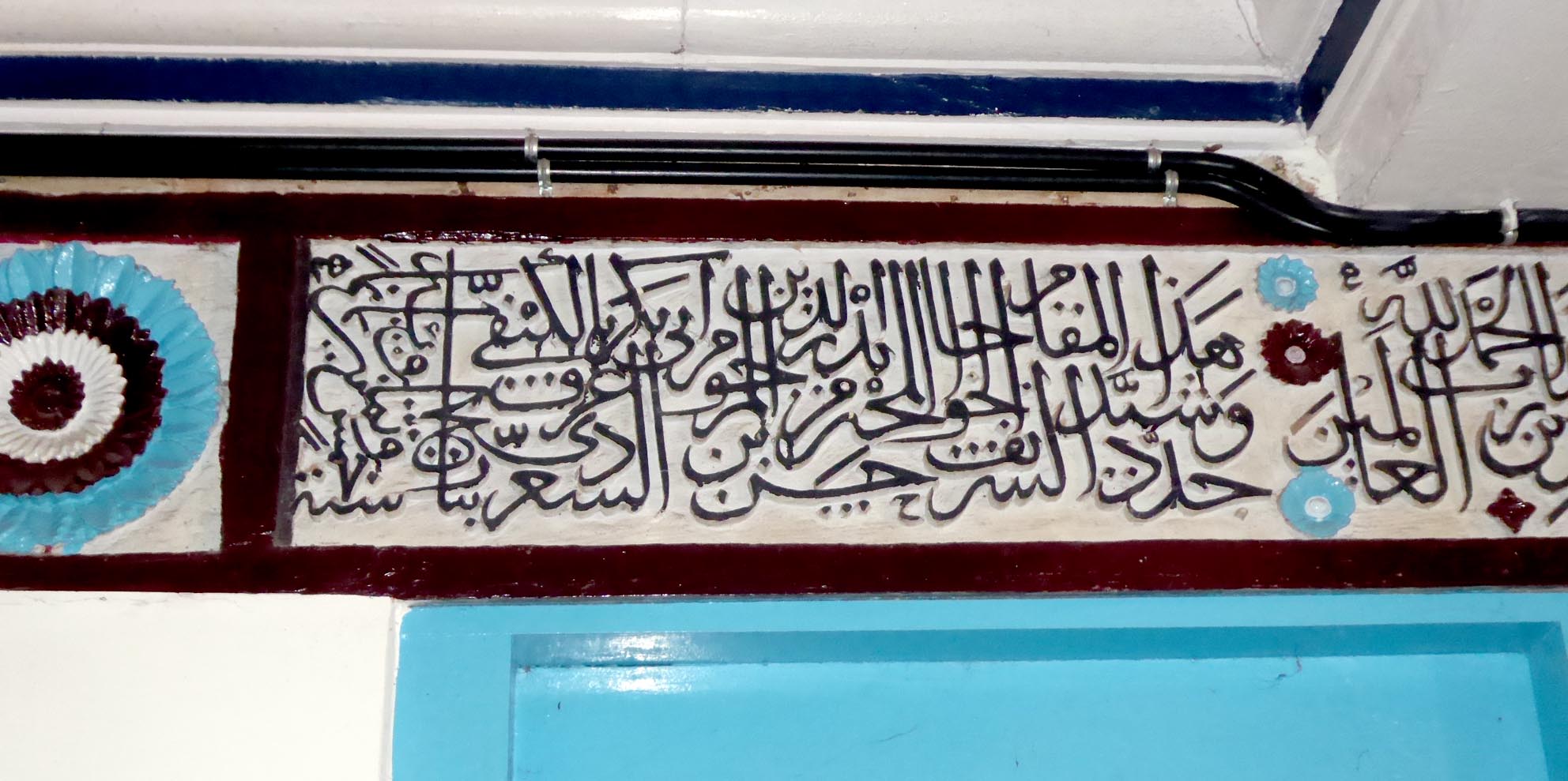 A comprehensive chronological list is then given of all known Muslim inscriptions in Malabar, mentioning their location and giving reference to sources. Most of these inscriptions have simply been noted in the epigraphic reports, but have so far remained unstudied. Nevertheless, the list provides valuable social and historical information. Most of the tombstones seem to have been worn out, but the names of the deceased give revealing information on the composition of the community. Together the inscriptions of the edifices and the epitaphs speaks of the close network of Muslim communities in the trading posts of India and beyond. A comprehensive chronological list is then given of all known Muslim inscriptions in Malabar, mentioning their location and giving reference to sources. Most of these inscriptions have simply been noted in the epigraphic reports, but have so far remained unstudied. Nevertheless, the list provides valuable social and historical information. Most of the tombstones seem to have been worn out, but the names of the deceased give revealing information on the composition of the community. Together the inscriptions of the edifices and the epitaphs speaks of the close network of Muslim communities in the trading posts of India and beyond.
Calicut Jami`. The panel over the entrance
to the prayer hall recording the renovation
of the mosque in 885/1480–1.
It is hoped that the list will provide a stepping-stone for scholars to continue with detailed studies. The list is followed by a critical overview of such records, noting that in spite of the previous lack of proper investigation, considerable historical and social knowledge can be gleaned from their perusal.
 * “The Malabar Mosque: a visual manifestation of an egalitarian faith”, * “The Malabar Mosque: a visual manifestation of an egalitarian faith”,
M. Shokoohy and N. H. Shokoohy,
in: Malabar in the Indian Ocean: Cosmopolitanism in a Maritime Historical Region,
ed. Mahmood Kooria and Michael Naylor Pearson,
Oxford University Press, New Delhi, 2018, 307-337, figs 11.1-11.23.
ISBN-13: 978-0-19-948032-6
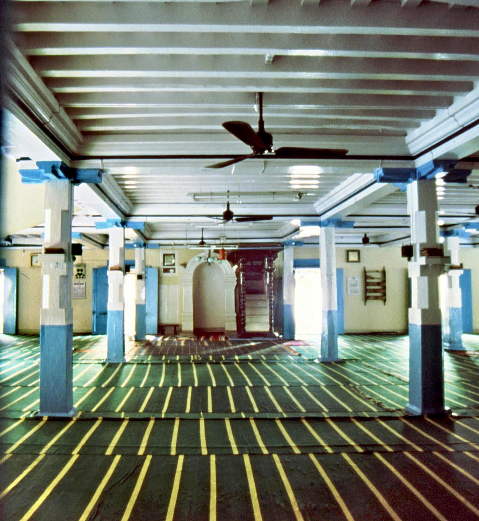 Calicut, interior of the central part of the Jami` looking towards the mihrab Calicut, interior of the central part of the Jami` looking towards the mihrab
and giving an impression of how the original mosque would have looked. The
modern blue and white paint has altered the original appearance, as the
wooden columns and ceiling would have been oiled and probably stained
with subtle colours.
The Indian Ocean trade did not begin with the Muslims. From the time of the ancient Greeks, Persians and Romans, people of many faiths – Jews, Christians and Zoroastrians – had settled on the India littoral, but no other maritime community had such a profound effect on the culture of their hosts as the Muslims, with the mosque as the architectural manifestation of their principal belief. While similarities can be drawn between the structure of the Malabar temples and mosques there was no parallel between them in concept or architectural planning. In a temple the gates and halls barred non-Hindus, outcastes and low castes from entry. Even for those allowed to enter, the dark inner sanctum of the temple was reserved for the Brahmins who performed the ritual on behalf of others. A mosque, on the other hand was a bright airy hall open to all. The prayer hall had no image of the sole invisible Almighty as a focal point, instead the worshipers prayed in the direction of Mecca, marked by a simple niche in the western wall. To all these differences one should add the concept of the khutba, the sermon usually delivered after the Friday prayer by the religious leader, guiding the faithful to the right path and furthermore giving the community – made up of merchants from different parts of the world – a sense of unity under the aegis of their single faith.
The planning of the Malabar mosques, consisting of an ante-chamber in front of the prayer hall differs from that of the sub-continent inland where there is no such ante-chamber. In Malabar a colonnaded porch often fronts this ante-chamber, a feature again absent in other Indian mosques. The Malabar mosque plan seems to be specifically related to the architecture of the trading communities and its roots can be traced back to the earliest Muslim settlements in Gujarat.
In structure, however the buildings employ the existing local traditional methods. This characteristic of the architecture of the maritime Muslims derives from the practice of hiring local craftsmen and using readily available material for building work. In the wider arena, the planning of the Malabar mosques resembles closely that of other coastal regions of India as well as lands further away – Malaysia, Indonesia and elsewhere – and in all these places local construction methods are employed, leading to striking similarities between the mosque architecture of Malabar and of South-East Asia.
|
|
 |
|
|